Sunday, May 24, 2020

The Covid Files #8 US 330 Trail

Looking toward the east.  We just rolled from that direction.  A few minutes later we were safely in our car and then the rain began and escorted us all the way home.

Sunday May 17, 2020 Melbourne, Iowa.  We park in front of Clark's Bar.  It is closed because bars are closed due to the covid-19 pandemic.  Too bad, I like this place.  On bicycle we are 50 miles from home.  By Honda CR-V I have no clue.  We are here to ride to our son's, Quin, and his GF's new flat in Marshalltown.  Since this will be a ride of moderate distance and all we need to carry is tire repair, water bottles and energy bars we take our fastest road bikes.   Fast recce ride of isolation.  Melbourne is the western end of the US 330 Trail that parallels its namesake highway.

Not a long trail by any stretch of the imagination, 8 miles according to the official State DOT trail map or 11.1 miles according to Trail Link,  nor a destination trail by any means, the 330 trail is an important link between the metropolitan Des Moines, Iowa, area and Marshalltown.  Ames, IA, is included.  Central Iowa.  From our home there is an 11 mile gap in the trail system connecting this trail to the Chichaqua Valley Nature Trail.  But this distance is remedied by S62, a paved county road  that runs from Baxter, Iowa, the eastern end of the CVNT, to Melbourne.  This is also known as Hart Ave and it was spruced up when Ragbrai rolled on it a few years ago.  Hard surface, light traffic and only 3 hills.  Rumors of a connecting trail have floated.
Another connection from the unpaved  Heart of Iowa Nature Trail exists but it ends in Collins, IA, but is slated to resume in Rhodes, IA, 4 miles shy of Melbourne and requires the use of gravel roads and a muddy flooded tunnel.  From my home in Des Moines this is not only out of the way but limits what bikes I would use.  Interesting how close I was to this a few weeks back but now I know the way.

The sign on the door of Clark's Bar.

Clark's Bar.  They do serve food here.  We always stop here when the bicycle journey takes us through town.  The owner once told me that on Wednesdays people from Marshalltown ride to the bar for tacos or something.  I have yet to be here on that night.  Head north from the bar, take a left when you have to turn and a right when you have to turn again and the trail will appear.  Turn east, right onto the trail.  Simple.

A few minutes later a truckstop/convenience store appears on the other side of the highway just north of Melbourne.  Restrooms and everything but Gatorade.  Food is available, to go because of the covid.  Showers are available, too, if you feel the need.  $7 includes towel and soap.  Used to be $5 according to the sign.

That sky...
West of Melbourne at the end of the ride.

From the highway this trail looks boring.  For some people it would be.  Nothing but a glorified sidepath in the middle of nowhere Iowa.  But once on the trail one sees the beauty.  That highway on your side is the bottom frame of a HUGE Iowa sky.  Today's sky was painted in carious shades of grey from blue to black as the sky was unsettled with rain.  Lucky for us it did not rain while we were biking.  The other side is framed by farmland and birds and the painted sky.  Much better than the sidepaths or Waukee or Ankeny.

US 330 Trail has a hard surface.  Every mile is marked by a 9-1-1 stenciled painting with the distance beginning in Marshalltown itself.  For instance the last marker we saw was for mile 19 west of Melbourne.  Intersections are not paved and can be rough especially after rain.  Rocky, sandy and muddy.  Before long just when the enjoyment kicks in the trail takes an overpass and crosses the highway and a few minutes later it turns left and officially ends near Grimes Farm Nature Center outside Marshalltown.  Here the trail connects to the Marshalltown trail system starting with Linn Creek Recreational Trail.  This is a beautiful trail that goes through town.  Today we we not on the trail for very long.  This trail is used frequently by pedestrians, families and cyclists.  We encountered many people.  Should be noted that we encountered only two cyclists on the US 330 trail.

We did see some blue in the sky.  This was taken on our way to Quin and Kayla's place.  The following photos were taken on the way back.
My bike on the abandoned bridge looking west to the bridge over Linn Creek.  Fitting that I chose this bicycle as it was the first major ride with new wheels.  My first major ride on this bike was on the Marshalltown's Marshmallo Ride back in 2008.  It rained hard on us that day.  Today no rain until after we loaded up the vehicle for the trip home.

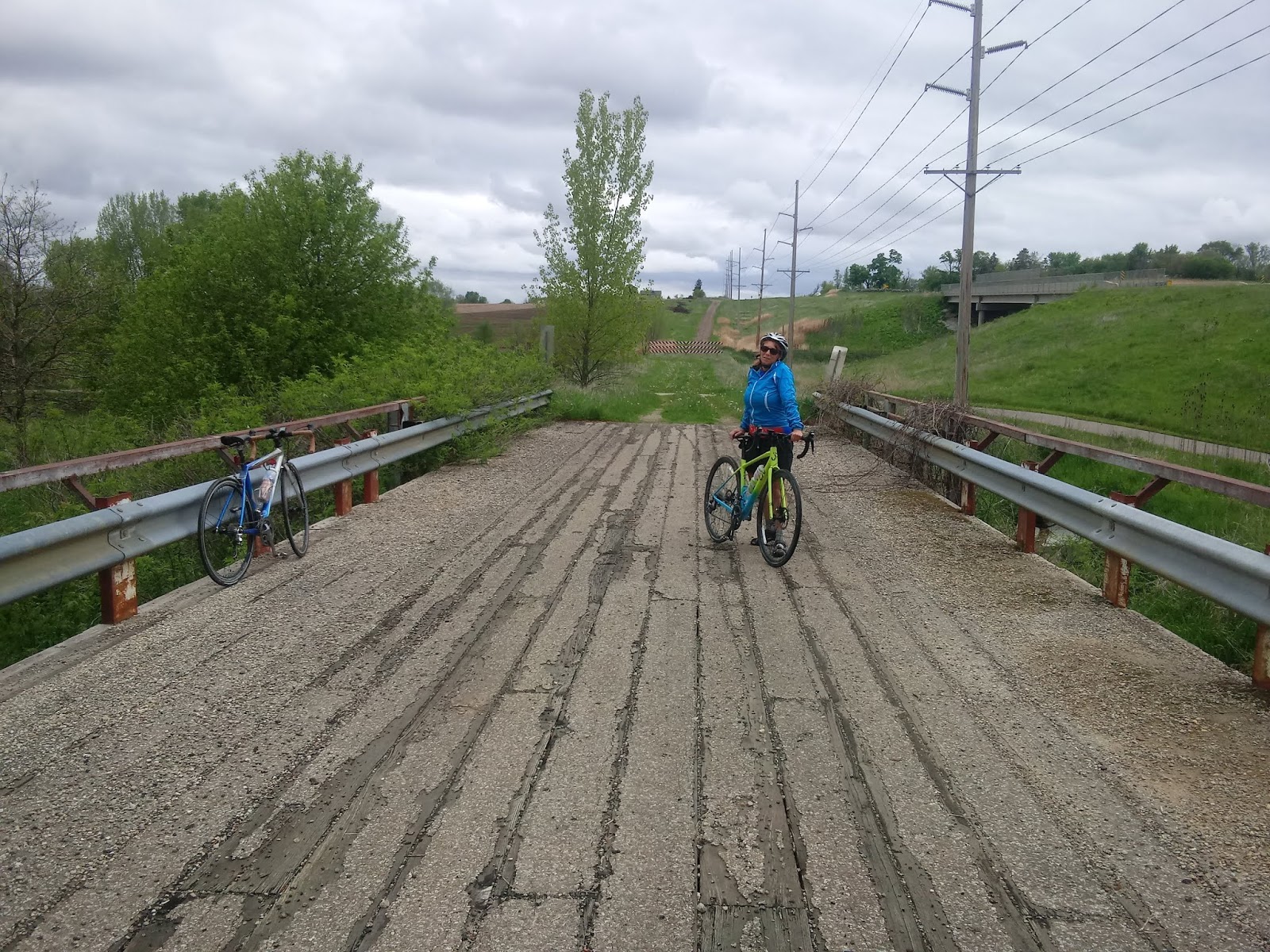
Perfect place for bridge beers.  Nobody uses it.  The road is closed.  The railing is good for leaning your bicycles.  Plenty of room for social distancing.

Mary practicing social distancing on this bridge.  Notice the sky.

 On the return we took the trail past Melbourne and discovered that it has a tunnel that goes underneath the highway and on the other side the trail is no longer paved but leads to a parking lot off of Gerhart Ave.  Had Joe and I headed north out of Rhodes then taken the first right we would have discovered this and had a century plus avoided that terrible gravel road.  Maybe next time.  The tunnel itself was a dangerous proposition.   Dark, muddy and flooded by recent rains it was a miracle that neither Mary and I crashed.  The worst bicycle tunnel I have ever ridden through.

A quick note about the weather.  My memories of these rides will be one of grey skies, rain or mist and cold temperatures.  Mary and have had maybe one ride during the pandemic that was sunny, warm and dry.

Verdict:  a mere means to an end or a nice ride into the country to visit a major community near the center of the state?  This trail, these trails, have been part of our adventures.  Mary and I rode on them on our trip to Cedar Falls, Iowa, and the Cedar Valley Nature Trail a few years ago.  Two years ago our team started in Cumming, Iowa, and overnighted at Riverview park at the eastern terminus of the Linn Creek Recreational Trail.  I know that we shall ride this again.

We covered over 30 miles this day.  It would have been a 130 mile round trip.  I am planning to do that some day when the weather is good.

Tuesday, May 5, 2020

The Covid Files #7 The Pioneer Trail


Saturday.  Time to leave town in order to experience a covid free bicycle ride.  Des Moines is too crowded these days.  Isolate elsewhere.  We drive within shouting distance of Waterloo.  The Pioneer trail is our destination.  Holland, Iowa, to Reinbeck, Iowa.  12 miles of isolated limestone goodness.  Mary took her touring bike.  I took the abused Substance.  We drive to Grundy Center, Iowa, to locate our lunch destination, the Landmark Bistro, before driving another 3 miles to Holland and the beginning of the trail.

The Pioneer Trail uses a former Rock Island Railroad line that connected Wellsburg, Iowa,  to Reinbeck.  It is roughly 12 miles in length each way.  There are two or 3 missing sections that are easy to connect back on the trail.

Seems like I've been here before.  We have.  Back in 2014 Mary and I took the tandem and passed through Grundy Center and took the Pioneer Trail to Holland on our way to Cedar Falls, Iowa.  If you wish you can read about that adventure HERE.  Also in 2018 we had lunch at the Landmark Bistro in Grundy Center.  For more on that great ride ride click ISO of Brew Pubs.


The trailhead is nothing fancy.  A kiosk and a sign at a parking lot.  As we unload a runner emerges from the trail and walks past us.  The surface consists a very finely crushed limestone on top of dirt.  It's a bit bumpy from footprints left from trail usage during wet conditions.  Bicycle tracks are also present.  Not a bad ride but could be a bit smoother.  Easy to find a line.  Within the first 3 miles, the distance to Grundy Center, we spot several benches and a shelter.  Canopy is good.  Two or three walkers greet us.
Wolf Family Preserve.  Hard to see this sign from the highway when riding east since the road sits up high.

The trail appears to end at the Grundy Center trailhead so we follow on the road where we can tell the direction of the old railroad.  We ride past the Richelieu dressing plant, the former Western Dressing facility and find where the trail resumes.  And after a short jaunt on the trail it disappears for a second time near the soccer fields.  Once again we follow on the road, State Highway 175, the path of the railroad from afar and find where it resumes at Wolf Family Preserve.

Giant Iowa Sky threatening rain.  We did feel the occasional sprinkle.

Typical Iowa farm field that has yet to be plowed and seeded.
From here no interruptions.  Mostly canopy of the trees that have grown since the end of the railroad we ride under with occasion openness to view the country side.  The surface never improves but every now and then a thick spot of rock grabs the tires.  For people on touring bikes it is enjoyable and a break from automobile traffic.

The sign for the park at the "end" of the trail.

Sizable shelter.
The Pioneer Trail will continue through here one of these years.
A State of immigrants.  We often forget.  There was a time when speaking German was illegal in some areas of Iowa.
The trail ends with at the edge of Reinbeck between a golf course and a small park with water and a shelter.  The town is visible from here and the more adventurous could continue on the former rail bed to where the trail resumes even closer to town.  As it is we are just a shade over a mile away with the option of riding on Highway 175 if we really wanted to visit Reinbeck.  There are restaurants and a coffee shop plus a Casey's there.  Not really sure what is open during the pandemic.  Time to turn around and fight a minor headwind and return home.

Reuben

Tenderloin.  Grilled is an option.

After we loaded our vehicle we drove into Grundy Center to the Landmark Bistro and picked up our lunch.  We phoned it in from Holland and they were very prompt on spotting us and bring out our food.  Curbside only because of the covid.  I did message them on FaceBook early that morning to see if they would be open.  They got back to me quickly.  Mary had a breaded tenderloin and I had a Reuben.  We ate on the table in front of the Chamber of Commerce.  Delicious!  Highly recommended!  No t-shirts this time unlike in 2018.

As for isolation, we saw a few people walking on the trail, usually alone or in groups of two.  As experience has taught us we saw bikes on the home bound leg of the ride.  This time may be one or two during the last 3 miles.  There were bicycle tracks throughout the length of the trail.  More footprints.  Horseback riding is allowed on the side of the trail and there is evidence of that.  Perhaps a sunnier day and no threat of rain would have increased the numbers.


Ideally I'd like to ride this trail again plus take the roads down to its "sister" trail, the Comet Trail, Gladbrook, Iowa, to Conrad, Iowa, and back to Holland via county roads.  Today we lacked the time and it looked like rain.  Sometime soon...


Sunday, May 3, 2020

The Covid Files #6 Rides of Isolation Let's Take A different Trail Home

Seems like I've been on this bridge before!

I cannot mention the name of yesterday's riding partner because of said partner's spouse.  Not that we did anything wrong, no booze for that matter, it's just said partner promised said spouse that It (I will refer to riding partner as It to protect Its identity) would be home by 530 pm.  One time It was in trouble because of a FaceBook post and I was asked to leave Its name out of social media.  The length of the ride was determined by my friend and I merely agreed with the plan despite the untimeliness of the real route.

Looks like Ohio!

Was it two or four weeks ago that made a phone call.  One of those "Hey I suddenly find myself with a lot of free time and I know you are recently retired and will likely be laid off from your part time gig due to the pandemic, would you like to ride some time soon?"  Positive reply despite being busy but I would receive a call soon.  Flash forward to Wednesday I got the call.  Since I have been almost everywhere I let my friend pick the route.  "The Heart of Iowa Nature Trail."  Kinky, I thought, but probably empty of humans.  "Meet in Ankeny at 9 am.  Bring your touring bike"  Cool.  Not my first choice of a trail for reasons pertaining to the nature of its crushed limestone surface but recent rides on such surfaces have gone well.  And such surfaces really limit the amount of people willing to ride on them.

We met at the FireTrucker trailhead and head to Slater and the Heart of Iowa Nature Trail via the High Trestle Trail.  A nice strong wind keeps us cool.  We stop at the Town & Country Market for Gatorade.  Yes, they have toilet paper in single rolls.  My obsession when visiting a store is to see if they have TP on the shelves.  What I don't finish of the bottle went into the panniers for a later drink.

On the HOINT I find the surface to be decent.  Not the fastest but I have made the right decision on bike and tires.  My default bagged bike, the Verenti with Schwalbe Marathon Supremes 700x35.  Rolls like a dream on pavement and wide enough for soft surfaces.  The only trail issue we have is in Huxely, Iowa, when we rode pasted the "TRAIL CLOSED" sign and judging by the assorted debris on the trail we knew why it was closed.  Funny how the man standing at the corner of that sign said that he has seen a lot of people riding through.  I guess riding until we fall into the Abyss is in the DNA of cyclists.  We like a challenge!

I have to admit that I thoroughly enjoyed this trail today.  You could say that we, this trail and I, have gotten off to a bad start many, perhaps two decades ago.  The surface was too soft and Mary and I rode the wrong bikes on it.  And a few other times it was meh mostly because of recent rain or snow melt.  But today it was perfect.  Maybe I will stop my campaign for the HOINT to be paved and focus on getting the trail completed and linked up especially to Melbourne, Iowa, with subsequent link to Baxter, Iowa.  But today we made our own links.

One last thing about the trail.  The trail was being used by people.  Bikes, runners, people with dogs and children.  The trail was not empty.  Not over crowed by any stretch of the imagination but the closer we were to the main towns the more people we encountered.  This was the busiest I have ever seen The Heart of Iowa Nature Trail.

Since the convenience store in Cambridge, Iowa, was closed we did not stop here.  If the shaker club still existed here it would have been closed because of Covid-19.  So we rolled on to Maxwell, Iowa.  Our stop was at Logsdon Grocery.  This store makes sandwiches and has beverages among other items.  WE each grabbed a store made sandwich in a plastic baggie from a cooler.  Had we known the future we would have purchased two a piece, one now and the other for later, Gatorade as well and consumed them at the city park.  The trail resumes at the soccer fields and we rolled all the way to Collins, Iowa, where the trail ends for now.  Here we paid our respects to Eric Crabb who rests next to his mother and sadly his recently deceased brother, Scott.

Decision time.  Here my friend presented Its true intention, an opportunity so to say.  Instead of turning around we should push on and ride to Melbourne, Iowa, and then take the paved road to Baxter, Iowa, the eastern end of the Chichaqua Nature Trail.  From there we would ride back to Ankeny and our vehicles on trail except the mile or two in Ankeny to FireTrucker Brewery.  I have often looked at the map and thought that this would be an excellent route once the trail is completed.  The only issue is how to get to Melbourne.

Time to pull out the map that I usually carry for just this sort of situation.  Of course, just when the ride is turning into a century ride with a big unknown route, it's no longer there.  OK Google, show us Maps!  What was it, 2 pm on a bright sunny day in a possibly data and service dead area and a 4 1/2" x 2 1/2" screen and my friend's iPhone that's possibly smaller.  At least we had service.  My phone had been on Airplane Mode most of the day to save battery and to silence it from calls, text, Twitter and email noise/distractions.  Take E63 to Rhodes and then find S52 and head south.  Simple plan.  Should have followed it to its fruition.

No cars on E63 and we had a gorgeous tailwind.  Got to Rhodes, Iowa, in big ring and in no time.  Stopped at the trailhead to rest and check phones.  Yes, still had business to conduct.  Check Google Maps again.  S52 is also known as Davidson Rd.  Take that road and we cut off many miles.  I was doing the math in head.  11 miles from Melbourne to Baxter, 20 miles to the Chichaqua Trailhead, 2 or 3 to Bondurant, 5 to Berwick and possibly 5 more to Ankeny and maybe 2 more to FireTrucker.  We were at 61 miles already IIRC.  Looks good, let's do this but when we got there but it was a gravel road so we continued to the first paved road which was also S52.  TAKE IT!!  330 was a few minutes away.  New dilemma.

Had I been given a pre-ride warning about this adventure I would have studied the maps and have taken E63 and the way to 330, crossed and picked up the 330 Trail and rolled into Melbourne proper.  But perhaps my friend was afraid I'd say no like others have in the past at the suggestion of this ride.

The road across the highway was gravel.  We could see Melbourne to the left.  To the right we could see another intersection.  4' shoulder but the speed limit was 65 mph.  We took a left turn on the shoulder to check out the next intersection.  On the way there two cyclists crossed 330.  This must be it!  So we crossed.  Wow, Davidson Rd again, gravel but we saw two bikes.  Straight shot to the trail.  Save some miles what could possible go wrong?

Crossing the highway we discovered our two new cyclists ended up being mere boys.  One was riding a bike that did not have tires!  Ever the optimist I searched for tracks.  None.  Perhaps the adults ducked into the first farmhouse, we were a few minutes behind.  But we crossed the road and had a straight shot to the trail.  Why correct a mistake?  We can do this!!

Apparently, Marshall County received its Stimulus Check.  With that money they decided to purchase new gravel and spread it on S52 and the roads to and fro the cemetery in Collins.   And by new gravel I mean the thick kind that buried every possible decent line.  Tried riding on the shoulder but that was a deep layer of dust laced with rocks.  Tried riding on the grass but that was not much better.  So it was a struggle and by the time we decided that we should have turned around it was too late.  Occasionally we had to walk the bikes up hills.  Downhill was another story.  I tried to keep the weight off the saddle to let the bike handle the blows better, perhaps prevent a broken spoke or bent wheel.  Regretting that I failed to pack a first aide kit and not looking forward to using the last of my water to clean my wounds I let it rip the best I could.  Easy on the brakes yet control the speed.  Faster yet slower.  Somehow we made it to the pavement without busting the bikes or ourselves.  typing this I can still see the dust.

A note about The Chichaqua Valley Nature Trail on this day.  There were more people using this trail than I have witnessed before barring an organized ride.  It was late afternoon on a Thursday.

End of story, right?  Stopped at Mingo, no water at the park, which was closed because of the pandemic, but we did eat the Larabars I had brought.  Miss the old school PowerBars but the L-Bars held up well during the trip. Text or call spouses and give them the 411.  New signs on the trail told the distance to Bondurant proper which kept my mind busy doing the math. Bondurant's Casey's was a two Gatorade and one pizza slice stop for me.  Drank one bottle and filled my empty water bottle with the other.  16 miles left if trail, 10 if road.  After consideration we went with the trail.  An attempt to save 25 minutes could result in epic/catastrophic  failure.  We were tired and beyond the longest ride of the year plus the sun was at Kill Zone Level.  No need unnecessary risks.

What could go wrong now?  We had never ridden this route together before.  We stopped somewhere on the twisty trail southeast of Ankeny to turn on lights and relieve bladders before crossing the interstate.  It (I almost typed my friend's name in) went straight and I, already turned and a few yards away from It, continued on to go under the I-35.  Neither of us saw the other's choice of direction.  We were separated now.  So I go underneath the freeway as I have always done and when I reach Delaware Ave the phone rings and it's my friend asking if I passed It or It passed me.  'I'm at the bridge.  Give me a minute."  So I wait and start thinking 'what bridge?'  Looking north I see my comrade at the other Delaware Ave intersection. Just roll on.  No time to pull the phone out of the jersey pocket and call.  Looking north again I can see my friend riding a parallel route against the backdrop of Ankeny LKQ  and when we reach the right turn I can see the flasher of Its bike but since I am a country block behind I never catch up.

In case you read this, Friend, here is the way through DMACC.

Previously we discussed how to get from the Oralabor Trail to FireTrucker.  "I always cut through DMACC but always get lost" I was told.  Me, I usually turn up State St and turn on Magazine then a left on Cherry BUT that is because when I ride there I take the roads from Des Moines and end up by the Git-n-Go on Irvindale and Oralabor Rd on the west side.  But that seems a bit out of the way.  I see my partner riding through DMACC but I'm on the wrong side of the road.  What the hell, cross at the first controlled intersection and work my way north.  Why did I not take the time to look at Google Maps and see what they told me to do?  So I blundered through and found Cherry and FireTrucker as my buddy was placing the bike on the truck's hitch mount rack.

It was dark now.  Respected text and phone call to the spouses.  Missed the 530 pm deadline by over 3 hours.  But we were 100% sober, no drinking ride, and honestly they should have expected it.  We smiled.  This was a outstanding ride, one of which we had for years stared at the map and wondered if it could be, should be done.  Should have studied the maps better.  Maybe get a strava thingie?  Next time.