Saturday, May 8, 2021

Headwind, Hills, Speed and a Century

The mural in Mingo.  Must be new.

The first full week of June will find us riding from North Dakota to Nebraska following the Missouri River and crossing all four locks along the way.  In order to enjoy ourselves we must suffer at home to get in shape.  There is also the need to test and break in my new road bike to see if it will do for a week long ride.  It was a long winter and a cold windy spring.  My commute to work is virtually nonexistent so my weekends are sufferfests.  Usually it is very windy and cold.

The training plan is simple.  Build up base miles then attack hills.  Most importantly, train with someone that is better than you and will hurt you.  Living in Central Iowa provides plenty of opportunity for base miles with its assortment of paved trails.  Warren County provides the hills.

Our three bikes.  Left to right: Joe's Specialized, Mary's Liv Avail and my Trek Domane.

Looping the Raccoon River Valley Trail

Mary and I in Jamaica, Iowa.

On April 11 we met Joe Hildreth, founding member of Mary's Heroes, at the Raccoon River Valley Trailhead in Waukee and knocked out 70 miles.  We headed to Redfield first to avoid as much of the headwind as possible and to enjoy the tailwind from Perry to Waukee.  After the climb out of Redfield the wind hit us dead on.  Nothing to do but make forward progress. Eventually the turn for Jamaica appeared and we had a better wind.  We stopped in that town at Just One More for a $5 burger and a beer or two before continuing to Perry and the much needed full tailwind home.  19 miles of bliss from Perry to Waukee that day.  Good to serious saddle time.

The Hills are Alive in Warren County

Scored a GeoCouch on this ride.  My 104th.  I did pass one up 14 miles earlier in Carlisle this day.  The truly funny thing is that I scored one here before a few years back.  Forgot all about it until Randy, the GeoCouch King, mentioned it when he added this one to the map.

The next weekend we headed south into Warren County.  It was a 55 miler basically starting at Mullets and going through Avon Lake, Carlisle, Indianola and then taking county roads to Norwalk and eventually intercepting the Great Western Trail at Microsoft campus for a trail ride to home.  Got a few hills in which is necessary.  I would like to say that the GWT had the worst surface that we rode on.  Very noticeable from the moment we got off the road.

Ragbrai Road Show on the Sauk Rail Trail and 80 miles with the Chichaqua Valley Nature Trail

Spotted along the Sauk Rail Trail.  Stacy Bellcock said they do this every year.

The past and the future in one photo along the Sauk Rail Trail.


Maple River's dive bar.  AKA The Critter Bar with its assortment of taxidermy.  We found Craig holding court inside as everyone else headed to Breda.  Sauk Rail Trail


Craig and Kim almost made it to Breda.  Smiles not miles! We left them here talking to the property owner/farmer who was in his 80s and still working. 

Mary and I in cold weather gear on the Sauk Rail Trail.  I think I picked up a tick here.


A week later we were on a party ride on the Sauk Rail Trail.  The Ragbrai Road Show.  To ensure that we got miles in we started in Lake View and rocketed to Carroll with a 20 mph tailwind.  Mary commented that she could go on and on for a few more hours with this wind.  The devil to pay when we turned around but it was a nice ride from Lake View to Carroll.  Craig and Kim hosted a pre-event breakfast at the Airbnb they acquired.  After hitting the bar and brewery Mary and I decided to continue south and ride around Swan Lake, the only section of this beautiful trail we had never visited.  We caught up with the others in Maple River.  Good training riding into the wind.  Find a good position and pedal through it.  This is why I like drop bars.  Lower your profile.  Drop bars save lives!  Eventually we made it Breda and encountered our friends who also started in Lake View but would not be heading further south.  57 miles.  Instead of spending the night we drove back to Des Moines for another early ride.  The need for back to back high mileage days was greater than the need to get drunk.

Could have been the wind...Altoona, Iowa.  It was upright when we returned.

Someone got Flocked in Baxter!

The next day we rode with Joe to Baxter and back in some of the most vicious wind that could be tolerated on a bicycle.  It was from the south.  The Chichaqua Valley Nature Trail offers a modicum of protection form north and south winds but getting there or leaving there from Des Moines can be tough.  Bondurant to Altoona was the worst heading home.  I believe all three of us were blown off the road at least once.  We laughed, of course.  Crossing the bridge over I-80 was another laugh.  The side of the bridge was maybe 2.5 feet tall.  One sudden gust of wind from the left could have pushed us off the bridge.  Of course that is where the wind was coming from.  None of fell to our deaths on the interstate.  80 miles.

Places of note on this trail that we visited or tried to visit...

    Bondurant: Somewhere In The Middle coffee shop.  Excellent brew and espresso.  

    Baxter: Kountry Korner gas station.  Great pizza and subs plus Gatorade or whatever liquid you             require to rehydrate with.

    Mingo: The Greencastle Tavern.  Closed on the Sunday we rolled through

    Altoona: Old Town Tap.  Lots of room in back and a dog named Harley that hiked a leg on the darts         machine.  I wonder if there is a bar in Japan with a dog named Suzuki or Honda?

Return of the fast triple

Thus far the LeMond's only ride of the year.  The P-51 Mustang is painted to honor the Tuskegee Airmen. 

Same ride.  USAF F-16 on loan from the USAF Museum in the livery of the 132nd that flew these from Des Moines.  Unfortunately, the wing was replaced by USAF drone training center.

The next day I took my old carbon roadie out for a 25 miler.  2007  LeMond Versailles with a mix of Ultegra and 105 triple groupo, Campagnola Sirocco wheels with Vittoria 700x25 tires.  Just wanted to do a comparison between the bikes.  This would be that bike's first ride in 2021.  I always felt that the LeMond is a faster bike and better climber.  It is lighter bike especially in back where it does not have the Domane's HEAVY monster cassette.  I often call the Versailles my Century Machine because it is a comfortable bike and a good choice for 100+ rides.  

So the latest trend in the past 13 years was the elimination of triples on road bikes.  "They shift poorly."  "Just put a monster cassette on back and you'll have enough gear to make it up mountains."  True, the front derailleur on a triple shift crappily.  But I always thought that was the price to pay for saving my lungs, legs and knees.  Even the shift from middle to big ring and back down was never smooth.  Two flicks of the wrist.  But this never bothered me because I could climb the steepest of the steep with that 30T granny gear. 

The first part of the 25ver I noticed that the LeMond lacked the ISO Speed suspension system.  It was like riding on rails.  Felt faster but then the feedback of the road and trails were transmitted clearly to my body, most noticeably to my feet.  Straight from the tires and wheels through the pedals to my feet.  Guess it is true about the Domane being better on rough surfaces.

Secondly I began to understand the advantage of doubles with monster cassettes.  When climbing hills like any rational human being when speed starts to bleed away a flick of the right wrist to move the chain to a bigger cog in back to maintain RPM.  The Versailles has 10 in back.  Lots of shifting.  But there are times that I have ran out of gears in back and this calls for a downshift for the front and then the necessary upshifts in back to return to the appropriate cadence.  As a result there is a loss of speed and loss of rhythm.  Thinking about it, if I am going to need to use the 30T I should swallow my pride and downshift to it EARLIER before running out of cogs in back.  With the Domane's set up just work the back and only adjust the front derailleur to prevent the chain from rubbing against it.  The weight penalty is negated.  Less work and smoother climb. Now if there was a cassette with the same size cogs with half the weight...

The Century Test

Old map of the area our century ride took place.

Here are the routes for the 80 and 100 miler.  Reminds me of the dead dragon on Atari's Adventure game.

Humans are superstitious about numbers and assign significance to them. 7 is lucky.  13 unlucky.  10 is perfect.  12 is called a dozen.  26.2 is an amazing feat of legs and feet.  420 makes stoners giggle.  666 is a warning.  100 miles is mind boggling for those who never had a bicycle saddle planted up their arse several or more hours.  But for some of us, 100 miles is a great test of our abilities.

On a beautiful Sunday morning in May we put it all on the line.  Filled our bottles and left and jackets and long pants at home.  No gloves or ear warmers either.  Kinda felt like we were naked since for all our previous rides required warmth layers, tights and long sleeves or jackets.  In 2019 we learned how to ride at 50*F despite dressing for 80*F.  Those layers become useless cargo in an hour.  Rule of 3--3 hours without heat...

Mary and I met Joe at the park in Cumming at 8 am.  Mary and left our house at 7 am.  The three of continued to Martensdale, the end of the GWT.  Refueled at the Jiffy Xpress gas station (the Gatorade cooler is along the wall by the door).  Then the 4 miles or so to St Mary's.  The first mile of R45 is flat.  Mother Nature was kind enough to supply us with a 20 mph headwind to keep us cool.  No momentum to start the first of 3 climbs.  Work that cassette until the summit is reach.  Big ring for a moment and move the chain out in back for the taste of a downhill.  Start climbing again and drop into the 34T chainring and start moving the rear of the chain inward.  Repeat and Regroup.  PRO TIP: there are kybos at the ballpark west of the church in St Marys.

New Virginia, Iowa

8 miles to New Virginia.  This section contains some of the best hills in Iowa, namely Pfeiffer Hill.  Back in 1991 on my first Ragbrai I spent what felt like 20 minutes climbing this bastard on a Trek 7000 MTB with slicks chatting with Heather Wince.  The next year Mary I got the extreme pleasure diving bombing said hill on our Gary Fisher Gemini tandem at 50+ mph!  We repeated that once more and IIRC (Cynthia IIRC = If I Remember Correctly) 50.3 mph is our speed record.  CrazY?  No, that bike is SMOOTH as a fine Cadillac or fine European luxury sedan at those speeds.  Just let the speed bleed a bit before crossing the bridge.  As for climbing it we noted that the hill has lacked some of its luster.  There was a time that Mary and I were on the Cannondale tandem pulling a Burley trailer and I asked her if we had past that hill yet.  We had.  Today  Mary reached the top with one cog to spare and I shameless got there with no gears to spare but I was not hurting, just slow.  I would have been in granny on the LeMond or wishing that my 1994 Trek 2200 was lighter and had more gears.  That goal reached I knew that the Domane could get me up any hill even at 5 mph.  A few miles later we regrouped in New Virginia.

Lots of nice homes here but not much in the way of the needs of cyclists these days.  The gas station is still closed and for sale.  The store closed a decade or so ago.  The tavern has been closed for years. There is a cafĂ© but it is only open Wednesday through Friday from 11am to 6pm.  There is a Kum & Go 3 miles west of town but that road turns to gravel afterwards.  However, there is nice park with a large shelter.  We rested and discussed our next move. 

Option 1: turn around here and go back and enjoy the tailwind and hit a speed record on Pfeiffer Hill but only get 72 miles for the day, less for Joe since he started in Cumming.

Option 2: continue south, cut over on Highway 69 for a mile or so and then turn on R35 (Truro  Paved Road) and head north to Truro, Winterset and Cumming.  Tailwind included. Joe's idea

Cylon

We chose the latter, speed record to be attempted at a later date.  The desire for the Century outweighed that downhill on real estate we already purchased.  Looking at Google Maps it made sense.  traffic would pick up on Highway 69 but we would not be on that road for long.  What I failed to see was that this would be a 23 mile ride before we reached Truro and its convenience store for victuals.  36 miles into this I had most of one bottle, and empty bottle and 2 energy bars.  It was getting hot and I failed to wear a sweatband on my head or apply sunscreen.  Our hottest ride of the season with sweat getting into my eyes and an annoying bead of sweat going left to right and right to left and left to right on my helmet but in view of my eyes like that red light of the Cylons just out of reach of my fingers.  INTO THE BREACH ONCE MORE!!!

Marker at the Highway 69 intersection.

A comment about county road R45.  It is a nice road to bike on.  For its age it is in stellar shape.  One can determine it is an old road by the rusted iron chunks that have oxidized away.  No major holes or cracks the entire way.  Traffic was light and the only vehicle that did not give us much room was a tricycle motorcycle ridden by a fat dude and his fat arsed bitch on back.  We saw a quintessential American scene, a group of horses running with their colts along the pasture next to the road.  Does not get more American or Mongolian than that IMHO.

As far south as we got.

Highway 69 was a bit busier than any road we'd had been on or would see.  Of  note was a red Chevy S10 with all sorts of plastic body modifications driven by a woman.  We saw her twice.  Good looking truck and it reminded me of The Eagle's Take It Easy.  But we had the wind fighting us.  Eventually we reached the turn at Osceola and got off the highway and after a few miles we crossed I-35 and found ourselves on 151 Truro Paved Road.  Joe said put it in big ring and that was the last that we saw him until Truro was reached.

We eventually got a tailwind.  The road was now named Wild Rose Rd.  Looks like a gravel road on the satellite view on Google Maps but it was asphalt.  A sign said PAVEMENT ENDS and more said ROUGH SURFACE but it was a better bicycling surface than the Great Western Trail.  Remember that sweat bead going back and forth on my helmet?  On the this downhill it went SPLAT on my right lens of my sunglasses!  What I thought was Truro was at a bottom of the hill and glancing at my computer I saw it reading 39.5 mph!  Damn, I miss breaking 40 mph but then I realized that the Domane was feeling and handling great at this speed.  Once the hill ended a scroll through the bike's computer revealed that I reached 40.3 mph.  I was happy but that happiness ended when I climbed up the other side and realized that the town was not there.  Damnit Joe, where the fook is this town?  This is one of his routes, his turf.  Eventually...Funny thing we saw was a house that looked like many remodeling projects were started and there was a concrete pad with a sun faded kids Oscar Meyer Weinermobile on it.


Interstate 35 High School.  My view from where I sat outside the Shop  & Save.

Out of water, a desire to wash my face, hard time chewing a Slim Jim beef stick and some blueberry highly processed muffins and chugging down a Gatorade and wondering what to do with the extra bottle of water I purchased not knowing that Mary had also bought a bottle, we sat outside the Shop & Go looking at all the locals who kept their SUVs and trucks running (for the a/c I imagine) and did not wear masks (speaking of which we did not consider putting ours on as we walked like zombies, vaxxed and ready we are) and the famous I-35 High School while recuperating. I did the math, it was a 23 mile stretch.  It was also decision time.  Skip Winterset and the hills to Cumming when we reach St Charles, return to St Marys and use the tailwind for the rest of the trip.  We should have 100 miles by the time we reach home.  All agreed.  Winterset would add even more miles and was not a necessary stop.

Life is better with a tailwind!  The road to St Charles was fun and fast and offered another 40 mph+ downhill (sadly I hit 39.5mph here).  We skipped the Casey's although I was searching for a bandana at the Shop & Go.  The four miles from St Marys to Martensdale felt like it took 5 minutes!  That jet stream's push up and down those hills was awesome!  Back at the Jiffy Xpress, same woman working the the counter, made us a Godfather's pizza with we enjoyed at the trailhead with a 6 pack of Bud Light.

Interesting conversation with another cyclist


If only...

An older man on a Trek aluminum road bike stopped at the shelter to rest and talk.  I would print his name but I wish to protect and respect his privacy (not that he asked and not that the 10s of people reading this would make a fuss but if you want to know ask me in person) He was with the Iowa DNR when the Great Western Trail was built.  Apparently, the IDRN had the rights to the railbed  all the way to St Joseph, Missouri! How many times have I spoke to friends about how cool it would be if the GWT went to Kansas City?  How many of the KC mile markers on how many trails have we seen in the past.  And now we learn that this was almost a reality.  According to him, Madison County was the reason that this never came to be.  Property rights, maintenance concerns, bridges ect...shortsighted twunts in the 1980s.  If it happened today the pro-trail side would fight it out and buy them out.  But back in the day we lacked the power and cashola.  As a result of this battle, legislation was introduced and passed that prevents the State of Iowa from buying land for trails.  Insert image of Charlton Heston on his knees at the collapsed Statue of Liberty from Planet of the Apes.  I am so upset that I wish I never learned this!  Think about how great this would have been not just for cyclists Iowans but also for those in Missouri.  I truly think this would have spurred that State to do more for trails other than the Katy Trail.

Completing the Century

Victuals in Martensdale.

After refueling, basically the only meal we ate on this ride, we rode another 8 miles to Donnie's house.  Not only a founding member of Mary's Heroes but Joe's brother.  Two beer stop.  Donnie cancelled RASDak because of a long winter off bike, back issues and possible a near death experience on gravel which killed his desire to commute to work via bicycle.  Their brother Sam was there as well and he says he plans to get back on his bike after and incident of Ragbrai, on route BTW, nearly destroyed his ankle and left him walking with a limp and denied him of his favorite activity, backpacking.

After our good byes it was time to ride the remaining 15 16 17 miles home.  This would be the only time I truly shine on such rides.  When we reach Water Works park no matter how long I have been on the bike the hidden Speed Reserve which I can never tap when I truly need opens up and I ride fast and probably like an arseluetcher through the crowded trail leading to Mullets.  But, damnit, I deserve this!  Selfish I know but it is home turf and I got the rhythm and power.  My bike and this speed at this point of the ride is my Emotional Support Animal.  I did not kill anyone or run anyone of the trail despite two inline skaters skating side by side as I passed a roadie.  Sorry, not sorry.

End This Post

I had to go an extra block to get this.

The lack of a triple does not hinder road bikes IF one is in shape.  The Domane is truly and endurance machine despite the weight penalty.  100 miles, 100+ smiles.  It is sunblock season.  Sweatbands too!  We are ready to ride across South Dakota.

Thursday, December 17, 2020

A Wonder Ride in Winter

The "spot light" on the trail through Gray's Station.  Photo shows my winter bike.

Christmas is next week.  2020 is coming to an end.  Not soon enough for most of us but I hate to say this but 2021 is not going to be an automatic improvement.  I'm still riding.  27*F and I have returned to riding the Single Speed after Saturday's snow put me on the Winter Bike for most of the week.

It was a simple short ride.  One and a half miles to Hy Vee for ice cream and booze.  I have no idea what to get my adult except stupid whiskey sets with glasses or Christmas ornaments.  Seems appropriate as the world could literally end tomorrow.  Chocolate ice cream for Mary and I and half and half for my coffee.  Simple pleasures.  Take the long way home via the wonderful trail system of Des Moines.  MLK sidepath to Gray's Lake Station and then around Gray's Lake itself.

Gray's Lake Station was wonderful tonight.  A light fog engulfed the new residential neighborhood and trail.  Really made me appreciate what a wonderful city I live in.  The closer I got to the lake itself I could hear the sound of air being sucked into jet engines, mixed with glorified kerosene, compressed and ignited and blown out the  rear of turbo engines.  Someone is going somewhere while I ride my bicycle on an asphalt ribbon between fields of snow.  Tonight all the lights are on.

I am a little disappointed that the lights on the Rainbow Bridge are covered by the snow the plow pushed to the side.  Tonight they are green but one needs to be on the bridge to see them.  Yeah, I need to bring a shovel....

Apparently this is the only decent photo I have of the Rainbow Bridge.  New phone and new computer and lost memories...


But from that bridge I saw something spectacular.  A pink glow from the tunnel connecting the lake park to Water Works Park.  The lights of the tunnel have been dark for about a week or so.  I thought it was from the original issue of the wrong solar charging system initially installed when the tunnel was completed.  Nope.  The same lights used on the bridge are now operating in the tunnel.  I stop for a few photos and then continue my journey home.  Although it is below freezing it is not cold enough for ice cream.  The bridge that crosses the lake is another beautiful sight at night.

The Winter Bike on the bridge crossing Gray's Lake.  These are the magic moments.

During warmer times if the sun and the clouds are in the right position one can experience this.

The people of Des Moines are very fortunate to live here.  Other cities may have better infrastructure for commuting but we have the ability to disappear for the ugliness of urban environments.  Even in winter.

Monday, December 7, 2020

Foggy Notion To Ride To Redfield

Between Waukee and Ortonville, the foggy white horizon.

Forecast was to be near 40*F sunny and dry.  It's my Monday off from work.  Time to add some miles to this last month of 2020, Covid be damned.  So I picked the section of the Raccoon River Valley Trail (RRVT) that I have not done this year due to construction.  Waukee to Redfield.  This year the caretakers of the RRVT have had this 17 mile section closed for construction on the many bridges between Adel and Redfield, 8.5 miles according to signage.  Work has been completed and I desired to ride somewhere I have not been a million times this year.  Load up the CR-V and roll!

Trailhead in Waukee.  My CR-V.  Fog.

Another photo of foggy Waukee.  I did not expect this on my return.  Photo taken at the start of ride.

It was 30*F when I pulled into the trailhead in Waukee.  I could have ridden from home but I did not want to make this a 70+ mile day plus risk my life on the sidepath along Hickman Rd in Waukee.  Junk miles.  It was also foggy.  When I left Des Moines the radio said it was foggy but I did not encounter the fog until I was near Waukee.  The weather people said that this fog would burn off and the sun would be out.  Good thing I brought lights.

After I rolled past Adel, 7.7 miles according to signage, I saw the fruits of the construction.  The wooden railings on the bridges were replaced with black metal railings from Des Moines Steel Fence Co.  These are the same as those along the High Trestle Trail.  Also, a lot of the that 8.5 miles had been resurfaced.  It needed it.  Now they can focus on repaving Yale to the bridge outside Jefferson.  Hint, hint!  This has always been my favorite trail and sooner or later the bumpy sections are resurfaced.  Thus pay for your permit as the money is needed and used appropriately.

The sun also came out as I left Adel for Redfield.  And it was getting warmer by the time that town was reached.  Took a photo and left.  There had been a few other trail users between these two towns.  Walkers no cyclists.  The pedestrian in Redfield was walking two dogs.  After turning around and encountering her a second time I had to shout at the top of my lungs to get her attention as she and her dogs took up the entire width of the trail and she was talking to someone on the phone about a person with a drinking problem.  My previous attempts to get her attention fell on deaf ears, literally!

That is a blue sky my friends!  Redfield, Iowa.

Back in Adel I stopped at the Morning  Grind coffee shop.  Although it opened in May of this year we, Mary and I, only recently discovered it.  We planned to ride there on Sunday but those plans fell through.  My usual was ordered, 3 shots of espresso over ice and fill the rest with half and half.  The barista understood my weird request and made it perfectly,  $2 tip.  I drank it outside in the Sun's warmth.  Then back on the saddle for the last 7+ miles.
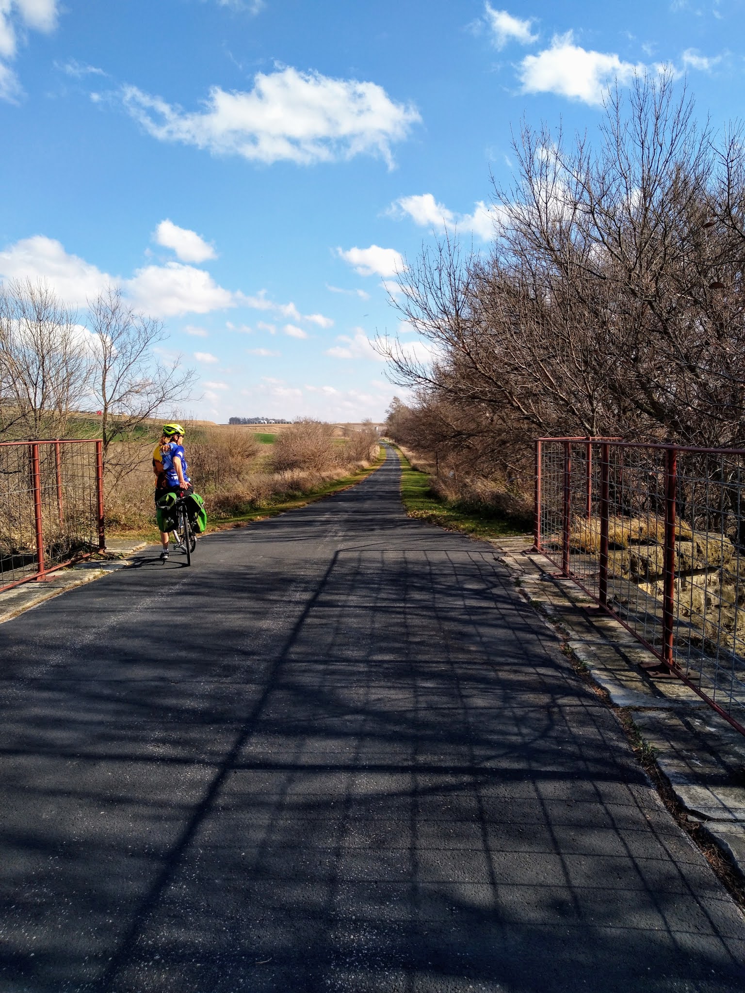
Viaticum, food for the journey.  7 something miles left in the ride and I had not touched my water bottle nor eaten anything after the ride began.  Three shots of espresso should do me good on a empty stomach!

After crossing the bridge over the Raccoon River, recently adorned with lights but not on during daylight, there is a 3 mile climb out of the Raccoon River valley.  I needed to climb to warmup again.  Funny thing is that when I reached the summit at Ortonville it was foggy again!  And colder!  My phone said it was 37*F in Adel but when I got back to the Honda it was 34*F and in Des Moines it was misty.  Finally reached for the water bottle to take a drink of water.  Icy spout!  At least I had some sunlight earlier in the ride.

Other cyclists?  Just on heading west on a fatbike just before I got to Ortonville.  Usually I see more bikers on this trail unless it is a late night ride.

Take advantage of these days in the 30's.  Soon it will be real, real cold.  

Peace out!  Ride on!!

Thursday, November 12, 2020

Omaha: Trails, Bridges, Beers and Nukes

Omar

Our original intent was to see the comedian Tom Papa at The Waiting Room in Omaha, Nebraska, but 4 days before showtime he cancelled.  A decision had to be made: keep our room and go anyway or find something else to do?  This late in the year every trail near home had been ridden to death and with a warm weekend, 70s and dry, our trails would be crowded.  Omaha has a large network or trails and bike lanes that are begging to be explored.  We were planning to take our bicycles anyway so we elected to keep the room and add extra miles now that we were free of obligations. So we loaded up the Honda and headed to NE.  Our bicycles were Mary's Bianchi Volpe and my Verenti Substance, both with bags for carrying locks and purchases. Mary queried whether or not we needed lights.  Yes, by all means, there may be a slight chance that they would be required.

I picked the Hampton Inn Omaha Midtown Aksarben because it is located next to the Keystone Trail.  This trail is 15 miles in length.  It starts at Democracy Park and heads south following the Little Papillion Creek then Big Papillion Creek to Offutt Airforce Base. Guaranteed 30 miles if we stuck to this.


The Keystone trail is paved.  It follows the creek as mentioned above.  Scenery varies from urban industrial, residential and prairie.  Highlights include a huge rail trestle that we rode underneath and the Airforce base.  The trail leaves Omaha and rolls into Bellevue, NE. 

Rail bridge with "debris shelter."  Apparently things fall off this bridge.  This was not the only bridge in the area that offered protection from falling objects.  Could use benches and tables here.

Because of a sustained 18 mph south wind we chose not to head north to Democracy Park and thus spared us a few miserable miles of headwind. There was plenty of headwind anyway. Several cyclists were spotted.  The ones heading north were smiling.


Keystone Trail.  When not in urban or industrial areas this is the scenery.

Our first trail closure on the Keystone Trail.

Blow this photo up and you can see where the construction ends.

The trail is flat with the exception of going underneath overpasses and then only a short charge up the other side.  The trail is also exposed on all sides.  Nearing Bellevue the trail is closed.  Not sure what was going on but large ROAD CLOSED signs blocked the way with orange snow fencing blocking the flanks all the way to the creek and water ditch.  The end of the construction or what we thought was the end of the construction was visible but we did not want to get our feet feet.  Another pedestrian/bike trail bridge could also be seen from here. So we consulted the Google and reversed course and took the road and the first left to head into Bellevue proper to get back on the trail.  One mistaken turn down a gravel road that looked like it lead to a place that crossed the creek and then a short hike to the trail was regrettably taken but I got scared that when it looked a little more private property with gun rights than I felt comfortable with.  So we did a mile of gravel, hip.

Once in town we got on a paved trail and saw two adolescent boys on MTBs.  I asked one, "is this the way to the Keystone Trail?"  "I ain't never been on that trail," he replied.  Never ask a local...  Another dumb move found us on a side path instead of the trail we wanted.  The two boys were on the right track but stopped to climb a steep hill on foot that lead to an abandoned bridge abutment.  They were so close to the Keystone Trail, closer than we were.  What separated us from the proper trail was a medical plaza, empty field and a anti-tank/bicycle ditch but we found a way.  Sure enough the Keystone Trail was here.  The path north was blocked with TRAIL CLOSED signs on the bridge we spied from the original closure so it was best that we found the detour in the first place.

Back on the path we headed into the wind again.  A few hard earned miles later we came to a trailhead.  A man rode up and asked if we had or were planning to ride the trail east of here.  Damn, I thought we were at the end.  Please note that kiosks lack useful maps.  "It's dirt," he said, "I got to the second bridge and turned around."  Just as well because if we did ride to the end it would put us further east than we really needed to be.  The only bad thing is that we'd would not be able to look at the Offutt from that side.  I wanted to see some aeroplanes.  Consult Google again and find a new route.  From here to Homer's Music, one of the best record stores in the Midwest and located near food and beer.  10 miles, one hour was the estimated distance and time according to Maps.  Damn, that's a long time.  Food was now becoming a critical factor.  We stopped at McDonalds on the way out of Des Moines, drove 150 miles or so, checked into our room and then left on bicycles.  Now we were 15 miles into a ride and 10 miles from a destination that offered quarter.  BUT we would now have a tailwind!

Ground Zero and The Deer

The Gate Guardian.  The oldest B-52G in the USAF inventory.  Offutt AFB

This place is targeted with nuclear weapons.  This place controlled the nuclear missile silos southeast of Missouri Valley, Iowa, from 1960 to 1964.

Google picked the Fort Crook Rd.  It had a wide marked bike lane.  But first we had to negotiate another ROAD CLOSED almost from the beginning.  A overpass over railroad tracks was closed for some reason.  Simple lift bikes over two sets of concrete barricades and then a left onto the bike lane.  Once on the lane our jets kicked in as the wind became our friend.  After a bit Offutt appeared to our right.  One can tell because of fencing and US Government license plates on vehicles and the use of razor wire around the grates of storm sewers.  Then we spotted the Gate Guardian!  A B-52 G, the oldest of the USAF inventory and flown to Offutt on July 10, 1989, is a static display or Gate Guard at the entrance of the AFB.  I told Mary that we are now at Ground Zero since the Soviets and now the Russians have targeted this place with nuclear weapons.  Really, the place to be as Churchill once famously said, "the living will envy the dead."

After photos we continued to let the wind push us north.  There were hills to our left and right but our route was relatively flat and we had no issues with speed.  Suddenly a two point buck ran across the street in front of me from the left.  He's gone so without further though I kept my pace up.  A minute or two later Mary starts yelling "DEER!"  Damn, she just now noticed?  When she caught up with me, one of the rare times that I was faster than her, my amazing endurance, she said that she thought the deer was going to tackle me.  How could that be, I saw him cross in front of me and he was not close?  "He came came back.  His path was blocked by a wall and he turned around and ran straight at you!  He got within 15 feet before he turned away from you!"  Of all the ways to get killed in an urban and metropolitan area, trampled by a deer.  One does not keep an eye out on right side of the curb unless there is an intersection.  I thought my furry friend knew where he was going.  Mary was more scared than I was.  Where's that damn brewery??!!??

So Google Maps gave us the direct route.  This was fine at first but the closer we got to the Old Market the more traffic picked up and the less bicycle friendly it was.  Sure, there were still "bicycle" symbols on the pavement and signs about "3 feet passing distance" in bright safety yellow and nobody honked but perhaps we should have stopped and made a new route.  Part of me just wanted to get there.  Part of me wanted to avoid the hills that were both to our left and right.  Part of me knew that in two miles we'd be in a brewpub.  Routing us by the zoo entrance not the best idea or by the entrance/exit of I-80 but alternatives would have added miles.  I failed to rate the route that Maps gave us.  I started noticing that after destinations Google Maps asks for reviews.  But we got there alive without anyone hitting, yelling or honking at us.

A juicy IPA and a whiskey at Brickway Brewery & Distillery, Omaha.


Brick roads of Old Market.  They suck for bicycles but Brickway Brewery & Distillery was easily spotted just around the corner from Homer's.  Colin and I stopped here last year during our visit to the SAC Museum.  Locked the bikes up on the railing of the patio with the new heavy duty Kryptonite locks we purchased from Fred's Bicycle Shop during my lunch breaks, just across the river from my work, this week.  Emphasis on heavy but it was time to step up my locking game.  We went inside since the patio was almost full and populated with smokers.  Got a table inside with more than adequate social distancing from the others.  The staff was friendly and fast.  I thought I read that food had to be ordered with alcohol purchase but after two rounds, one with their whiskey, I had to flag someone down for food.  Two giant soft pretzels and two slices of pepperoni pizza.  For me, a Hefeweizen, a juicy IPA, whiskey, and a hard cherry seltzer.  Mary had two rounds of the seltzer.  All very good.  Before leaving we purchased a Moscow Mule set for a Christmas present for one of our sons and a bottle of bourbon for me.  We then walked down the hill to Upstream Brewing Co but only order one round.

Seems Like I've Been Here Before

Omaha and Des Moines have a lot in common.  Along the same block as Upstream Brewing Co is the original Spaghetti Works.  I thought Des Moines had the only one.  Between the two brewpubs is Vinyl Cup Records.  I thought this was another uniquely DSM business.  To make it more interesting the same man working in this Vinyl Cup was the same person that worked at Ernie's Boondocks when VC was there on the night of my birthday and he remembered me!  Small world indeed!  Later we ate at Legend's, another Des Moines place that I did not expect to see in Omaha.  In the meantime when I was looking at vinyl Mary went to bookstore and another shop.  After a few purchases we stopped at Homer's and I spent more money on records.  Of note, Elvis On Stage, February 1970, live covers lp, Flame Job by The Cramps.

Once again I fired up Google Maps to direct us back to the hotel.  To my credit, I did study the map before we left Des Moines.  Lots of bike routes.  Now we needed a 6 mile route.  Traffic was light, the sky was dark.  Remember those lights Mary asked about?  They came in handy.

Farnam House not Farmhouse.

We seemed to be on Farnam Street for quite a bit.  Rolling up to some intersection Mary spotted a brewpub and asked if I wanted to stop.  HELL YEAH!  Farnam House Brewing Co was the third and final brewpub we visited on this adventure.  I knew that this was the place to be when a familiar drumbeat and bass riff began, Everything's Gone Green by New Order!.  That would be an obscure track for those not in the know.  Later a synth track by Ministry played.  Yes, I was impressed by the music.  The beer was great, too.  We both had their Cranberry Berliner Weisse, a sour.  Unfortunately just one, as we still had a few miles left to ride on unfamiliar streets at night after have several earlier.  I almost purchased a jersey but they lacked one in my size BUT I was able to get a Christmas theme sweatshirt for the price of a t-shirt.  As I am writing this I am contemplating wearing now as it is a cold evening.

The Elmwood Connector Triangle

Back on bikes we rolled through the drinking district of the University of Nebraska Omaha but we abstained.  There was even a brewpub although we did not see it at the time.  Then the Elmwood/Pink Panther Incident.  It started with a roundabout.  No issue, we successfully negotiated it without getting hit.  We were no longer in Party Town but in a nice residential neighborhood with a park on a beautiful autumn evening.  Two parks to be exact, Memorial and Elmwood.  Google told us to turn on the "Elmwood Connector" but we never recognized it.  My dense brain failed to understand that said connector was a pedestrian path not a street.  We circled a few times and listened to the "wrong direction" tone that Maps makes when one does not follow directions.  Finally I forced the point and took a trail that seemed to head in the proper direction and Google readjusted.  We were seriously close to our destination.  But every time I think of a roundabout I think of a time when a rock & roll band was lost in Paris and kept encountering the same roundabout so often that the manager threw his map out the window of the car only later to stop and pick it up after encountering the same roundabout for the umpteenth time.  Also this scene which seems fitting comes to my mind.


A few minutes later our hotel was located and we decided to have dinner at Legends (are there still any left in Des Moines?) and watch the ISU game.  35 miles.

Destination Bridge Crossed

Omelet, toast and salad at First Watch located near our hotel. Asked for coffee and they brought out a carafe!  Also had a kale and fruit tonic juice since I abused my system the previous day. I wish they had a Des Moines location.

Sunday we packed up and drove to the Missouri River.  But breakfast first at First Watch which was within walking distance of our hotel.  We highly recommend this place.  

Our destination was the Bob Kerrey Pedestrian Bridge which spans the river and connects the States of Nebraska and Iowa.  Something about bicycling and bridges.  This would be among the 3 greatest pedestrian/bicycling bridges we have ever crossed.  The High Trestle between Woodward and Madrid, Iowa, is one.  The Meridian Bridge in Yankton, South Dakota, is a double decker bridge that spans the Missouri River connecting South Dakota and Nebraska is the third.

Bob Kerrey Pedestrian Bridge over the Missouri River linking Omaha to Council Bluffs, Iowa.


My Verenti Substance in two States.  2020 saw this bicycle visit Minnesota and Wisconsin, too.  Had the rain not been so bad in July it would have crossed into Missouri as well.

Mary's Bianchi in two States.  It two was ridden in Minnesota and Wisconsin back in June.

The Might Mo, the Missouri River.  we were supposed to have followed it from Pollock, South Dakota to Vermillion, SD, in June but eh Covid-19 pandemic postponed that adventure until June 2021.  I'm looking forward to this!

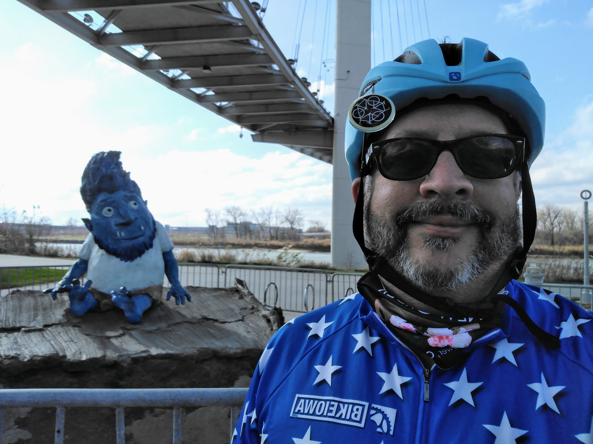
Omar the Troll.  My QCR reader did not work for this.  We saw this sign before we saw Omar underneath the bridge.

Bob Hope.  Product placement 101.  Reminded me of the depressing anti-suicide loud speaker broadcast at the Irvine Station Amtrak station in California.

Omar & Me.

The wind was stronger than the previous day and the sound of it blasting through the cables of the bridge was strange.  At first I thought something was wrong with my bicycle.  Oddly, no movement of the bridge unlike some other bridges we have been on.  After crossing and returning to our native State we explored the trails and found a spectacular derelict rail bridge that some billionaire needs to finance the rehabilitation and conversion into a pedestrian/bicycling bridge.  The Turnstile Bridge is a must visit!

In Council Bluffs after crossing the bridge.

In Council Bluffs.  The top rotates.

I recall spotting this in the distance and thinking "I gotta go there!"  Still owned by the Illinois Central railroad.

Just cut the trees down and rotate it.  Add a bicycle surface and connect it to the Omaha Trail System...


We returned to Omaha and loaded our bikes back into the Honda and drove back to Iowa.

One Last Ride

The Rock Island Stone Arch Nature Trail is located in Shelby, Iowa, just off I-80.  A mere 4 miles, it offers a a scene of farm fields and small town life as well as the stone arch bridge namesake and another bridge to visit.  I spotted this on the map months ago and thought why not?  Glad we did.  So if you find yourself with a bicycle in your vehicle as you traverse that freeway please take the time to get a quick 8 miles in.  Despite the now 26 mph wind from the south we enjoyed this paved trail.  Park at the gas station/cafĂ© at the exit and unload your bike.  Do not take the gravel path heading into Shelby.  That is not the trail.  We discovered this accidentally but if you like a fast gravel path with lots of bumps and a few quickly climbs, by all means take it.  PRO TIP:  look at the satellite feature of Google Maps when in doubt.


The Stone Arch.

The top of the Stone Arch.

The view north of the Stone Arch.

The final bridge and the end of the trail.

It takes people to do nice things.


At the park along the trail, Shelby, IA.


At the trailhead of the Rock Island Stone Arch Trail, this sculpture pays homage to Iowa's agricultural economy/heritage.  Notice the cow and pig in the cornstalk? Also notice how still the flags are?  26 mph south winds will do that!

It was a quick warm weekend, perhaps the last time we'll experience a weekend in the 70s until May 2021.  We left a lot of exploration of Omaha's trails for future expeditions and we would like to return some day soon.