Sunday, May 14, 2023

Return to Cinder!


Saturday, I took advantage of an opportunity to ride on Iowa's first rail-to-trail, the Cinder Path.  This was my third adventure on the unpaved trail that runs from Chariton to Humeston, IA.

The trail follows a branch line of the Chicago, Burlington and Quincy Railroad built in 1872 that ran between Chariton and St. Joseph, Missouri. The railroad later became the Burlington Northern Railroad, which abandoned the railbed in 1974. The Lucas County Conservation Board bought the corridor that same year and established the trail. *1

 My first time on the trail was in July of 2016. *2 Our team, Mary's Heroes, were returning from The Ragbrai and hopped on the trail at its southern trailhead in Humeston, IA.  Five of us on loaded touring bikes without fat offroad tires got as far as 2 miles before giving up and taking paved and wide shouldered highway 65.  Our bicycles were not equipped with the proper tires and were too loaded and heavy for it.  The trail surface at that end of the trail is essentially grass covering the rail ties..  The trail is groomed with lawn mowing equipment.  In 2020 Mary and I returned on our touring tandem with 2.2 MTB tires and completed the entire trail although the southern section saw us in granny. *3  For Saturday's adventure I took my gravel bike with 700x37 tires and had no intention of riding the entire trail.  My plan was to reach the covered bridge 6 miles out.

To make this ride more interesting was the rain.  Not that it was asked for.  Not that it was planned for.  It just happened.  Seems that every weekend it either rains or there is a 30 mph wind, both not conducive for enjoyable bicycling.  The rain hit on the way to Chariton.  On a narrow two lane highway I moved the wiper lever all the way down to fastest and desired another two levels of wiper speed.  The giant Ford F-350 farmdozer with bison bumper guard on me arse was not welcome, but my high-profile vehicle managed its best with my precious cargo, my wife and two daughters who were going to Chariton for a bridal shower for my future daughter in-law.  Interesting how we made it out of the last squall and dropped down a hill and instantly all the windows in my Pilot fogged up!  10°F temperature drop.  Damn A/C!  How all the rain from yesterday was to affect the trail I had no clue.  I had a change of clothes and blankets to protect the Honda from a muddy bike.  Yes, I was able to transport 4 people and the bike inside with only the third row of seats folded down.  Bicycles are safest inside a vehicle.  Dry, too.  Dropping them off at the house hosting the shower I drove to the trail.  I was told to be back in two hours.  Plenty of time.  The sun was out and so was the humidity.

The trailhead in Chariton is easy to find as it is right off highway 34 next to the Hardee's.  Plenty of parking under shade trees.  Expect to see people sitting in their vehicles having lunch or taking a break.  Once on the trail I immediately noticed the fragrance of flowers and was glad that I took two Claritin when I woke up.  The first bridge appears instantly and then the trail proper turns black from the cider surface.  It looks like rocky dirt and mud but it was quite smooth and dry for an unpaved trail during rain season.  I looked at my front tire and only the center showed evidence of moisture.  No mud and nothing flying on my face.  The trail surface absorbed all the water and sent it away.  Nice!

Front tire barely dirty.  The trail looks muddy but was not.  Cinders make a nice surface.

The trail has a shady canopy of trees and follows a river.  Both shoulders have water either the river or drainage ditch.  Sweet William, wild blue phlox, line the shoulders along with nettles.  The only issue with the trail on the Chariton side is that there is a section, not long enough to perhaps a tenth of a mile, of fresher limestone.  Thick and it will suck your tires into it.  I noticed that the trail here is much lower than the shoulders so it was likely a repair of flood damage.  Probably the only section of trail that is lower than the shoulders.

The first trail user I encountered was a rider of an e-Bike who was ready to roll when I pulled my car up.  Never saw him again.  Further along two women were on a bench.  They were on hybrids/MTBs.  


WALK THE PLANK, MATEY!!


3 miles into it there is a lean-to off the trail that requires one to walk the plank.  The plank is over the ditch that runs along the east shoulder of the trail, the Chariton River.  Crossing it rewards the trail user with a couple of benches and shelter from the sun.  Of course, I stopped and cursed myself that I did not bring a beer.  The plank is narrow so be careful and looks like it may have 5 years left of use in this manner.

It was here that I encountered another cyclist.  He was in his late teens or older on a Trek with flatbars and V-brakes, the rear disconnected.  The bike was covered with orange mud from the road crossing of 460th St.  Mud embedded from the tires to the bottom of the fork and brakes covered.  When I returned I saw his tracks on 460th.  Bad!  Bummer for him but he should have picked up one of the plentiful available sticks and got that gooey gunk off so he could roll without frustration.


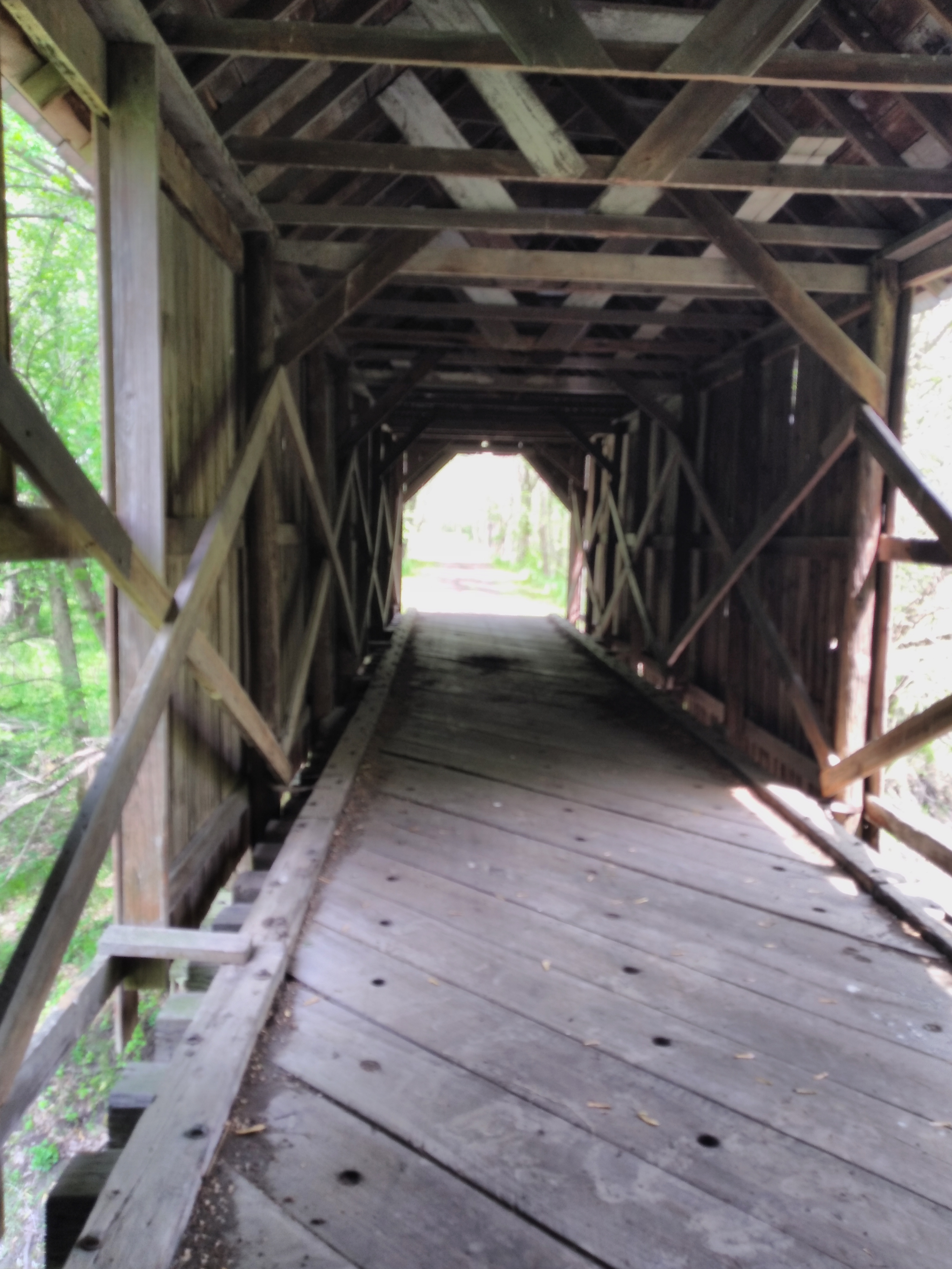

The highlight of the trail appears just beyond the 6 mile marker, a covered bridge.  When we visited in 2020 the trail was closed on this section for road maintenance but we poached it anyway.  This time the trail was open.  The bridge is still in need of repairs.  Part of the walls on both sides are missing.  And several piles of what possibly is bat guano are in the middle of the road.  Be careful where you step and ride.  Also, there is a deer stand on the north side of the bridge to the west so do not dress up like a deer during hunting season.

Deer stand

The way back was uneventful.  More cyclists were encountered.  The two women I saw at the first bench had made it to the plank lean-to.  Another person I came across was at the parking lot putting his bike away.  We both remarked on how good the trail was despite the rain.  However, we did not discuss how the ride back was.  It seemed to be uphill judging by my speed and effort.  Not bad but noticeable.  I did return tyo pick my family up slightly 2 hours after dropping them off.  They were happy for me.  Blue skies for the drive home.

Every bridge has this sign.  Given the low guards on the bridges perhaps a good idea, one bad move and you're in the drink! I had zero issues with the surface of these bridges.

I really want to return in the autumn to take advantage of the changing foliage.  It would be beautiful.  Perhaps to remember to smuggle a can of beer with me.

FURTHER READING

*1 Cinder Path | Iowa Trails | TrailLink

*2 Riding The Mindway: The Clockwise Swoop: Ragbrai 2016 (che-ridingthemindway.blogspot.com)

*3 Riding The Mindway: The Covid Files #4 Rides of Isolation Ishmael on The Cinder Path (che-ridingthemindway.blogspot.com)


Tuesday, May 2, 2023

Sakatah Singing Hills State Trail pt1


 We find ourselves driving I-35 north from Des Moines to Minneapolis several times a year.  Every time I look out the window at Faribault, MN, and see the brown signs announcing a trail and say to myself, "I'm going to ride that bugger one of these days!" Yesterday was that day.  Mary and I had tickets to a concert in the Twin Cities and the day off.  Threw a couple of roadies in back of the Pilot and left our warm home at 7 am.

Of course, I did the research first. If one is driving to Minnesota from Iowa stop at first rest stop after crossing the border.  This place has all the 411.  There are several free printed pamphlets about Minnesota bicycling trails.  Look up said trail on Google Maps and search for it with your favorite search engine.  The information is out there.  We discovered that the trail in question is paved, 39 miles in length and has towns that provide the provisions so we would not need to schelp supplies with us.  Two fast bikes with water bottles is all we needed yesterday.  Most importantly, such research shows where one can park their vehicle at the start of the ride.  The plan was to park at the Hy Vee grocery store in Faribault, pronounced "Farbo."

It was going to be a long, cold windy day.  Green Winter has Middle America in its grips.  My internal clock plus the needs of the dog and cat had me out of bed by 5 am.  Dog wanted out, cat desired fresh water and I coffee.  This seems to be the daily routine.  4 hour drive to Minneapolis.  Stop at Faribault for the trail.  It would be 40°F with a 24 to 28 mph sustained NNW wind.  Lovely.  Obviously, an 80 mile day was out of the question.  Although the trailhead was less than an hour away from the concert venue, we would have to change out of the bicycle uniform into something that would be appropriate for concert of an industrial electronic band and the people that are attacked to that noise.  Somewhere on the trail my left ear felt clogged and that sensation reminded me that I left my earplugs at home which resulted in a two mile hike to Walgreens in Minneapolis.  More time wasted.  Yes.  Mary wore a black dress with red stockings and I the latest New Order tour shirt, grey, to represent my tribe.  Probably need to eat before the show because beer + rock music on an empty stomach = issues.  And 35W in Minneapolis is always a fookin' nightmare.  We would ride 15 miles out before turning around at a Casey's convenience store.  Just a taste of the trail.

The office ride of Faribault's Tourism Board, Chevy Kingswood estate!  400CI V-8.  Given the lack of 5 mph bumpers I'm guessing no performance killing emission controls and smog pump.

At the Tourism building, Faribault, MN

Faribault is right on I-35.  We spotted a blue "Tourism Info" sign before we found the Hy Vee.  Why not? All the pamphlets were on an outside wall.  Found a map but then the greeter came outside and told us that everyone parks at the Dairy Queen on the trail and pointed us in the proper direction.  We passed the Hy Vee but the DQ avoided about 2 miles of crap urban riding with its intersections to cross.  Good call, great advice.

Once rolling we stopped to photograph the trail sign map.  Always a good idea.  Then we encountered the mileage markers.  A small brown Minnesota shaped piece of plastic on poles on both sides of the trail.  Both markers have the same mile noted.  37 was the first one we encountered.  The trail itself is asphalt and smooth.  Rail grade.  Remnants of the original rail line are scattered throughout.  Cancrete whistle crossing signs, WX, and large multifaced distance markers, M 39 for example, left behind as pieces of lost history.  M may be Mankato.  These markers are very similar to the ones found on Iowa's Great Western Trail, the Wapsi Great Western Line and the Chichaqua Valley Nature Trail.  This makes sense because line the aforementioned trails the Chicago Great Western Railway was the rail line that these trails descended from.

 About 3 miles from the Dairy Queen, Shager Couty Park, home of a large kybo. One more table outside of photo.  No electricity but there is a kybo just to the right.  Note that on May 1all the jettys and other structures that go into the water are still on dry land.

The trail is mostly flat, rail grade.  Highway 60 is on the south side and farmland and lakes on the north side.  There are houses and cabins on the north side as well depending how close they are to the lake(s). At times the highway moves away from the trail.  There is a kybo about 3 miles from the DQ for those who are in need.  A large picnic shelter is there as well with 6 tables.  Sleeps 6 as baggers would say.  The video below shows just how windy it was.  White caps on this otherwise peaceful lake.


There were few small towns that we rolled through.  Warsaw is just north of the trail and it has a bar.  Morristown is the next town.  It has a tavern (food) and a bar plus a liquor store.  Liquor stores are important in Minnesota since gas station convenience stores do not sell beer or booze.  Kwick Stars are the exception.  


Hobo hut.  Low ceiling.

The campground at the hobo hut.

Outside of Waterville is Sakatah Lake State Park.  The lake is on the north side of the trail.  We found a "hobo hut." a shelter that used to protect people from the elements.  This one is part of a campground with its open side facing the south.  If today was any indication, the wind is very strong from the north.  All sorts of outhouses are located on the lake side of the trail. In the park we had to "cyclocross" over two fallen trees that blocked the trail.  An attempt to perform community service and remove the first tree came to naught.  Then it was downhill to Waterville.  We stopped at a Casey's and got a slice of pizza and a Gatorade.

Thoroughly cold we said good bye to the headwind and enjoyed a tailwind back to our transport.  Strangely, we only encounter one fallen tree.  It was less than an hour after we were stopped by it but it was cleaned up!  Puzzling as we kept thinking it would appear at any moment.

As for trail users, we encountered about 8 pedestrians. No cyclists.  Monday morning may all the bikers have day jobs.  Maybe they thought it was too windy to ride.  As strong as the wind was it merely slowed us down and prevented us from overheating.  The trail is nice and smooth and in much better shape than the ones we have at home in Des Moines.

Someday we will ride the entire trail.  Today we lacked the time and ambition to ride 80 miles, half of which were into the wind.

Further Reading:

All Trails 

MN DNR

Wiki

Sunday, March 5, 2023

Art Ride

 " Cannot have art without meat."--Martin Heidegger


It would be nice to go back in time and attended University to retake the same courses without the ritual getting blackout drunk or calcifying my brain with drugs every weekend or third day.  Of course, keep the books.  I find myself longing for the philosophy books I highlighted during those years.  I could explain what this German thinker meant by that paraphrased statement but I'll let you, gentle reader, research that on your own.  Suffice to say, every time I make an effort to absorb art this thought enters my mind.

SUDAFED BLUES

Been fighting a cold, not covid, I can smell, coffee test was at 5 am this morning, and that kept me inside yesterday.  But today I felt better and made a special ride to obtain a photograph for Facebook's Bicycle Ride & Seek monthly challenge.  A photo of my bicycle with an egg in the background was the target.  I used the Google to find "egg Des Moines Iowa" and the South Des Moines Sculpture Park appeared in the results.  BINGO!!  I always wanted to visit this place.  

Located off of SW 9th Street and McKinley, it would require a non-direct route to get there via bicycle.  So, I consulted Google Maps.  Yes, I have surrendered my privacy to the Google.  Google gave me a pin for being a "Local Guide."  Reliance on Maps for bicycle and car travel is nothing I am ashamed of.  Two routes.  The "blue," recommended taking the established bike route within a half mile of the target.  Hop on the trail at Mullet's, all the way to the first trail intersection past Confluence Brewery and then turn left at Cassady Drive and stay on this hill as it turns into SW 14th and then left again at McKinley, cross SW 9th and BOOM THERE IT IS on the right.  The alternative was to take SE 8th with lots of residential areas and turns ect.  Missing option was to take the trail to MacRae Park, climb that bastard of a hill, to SW 12th and ride past Lincoln HS football field and cut over to SW 14th at Elder Lane which I have done before.  We took the recommended route.  My only issue with this route is that it is not marked properly for an idiot like me.  There needs to be a painted arrow on the pavement at the intersection of Cassady Drive.  There is a blue bike route sign once the turn is committed, however, all the signage up to this point is in green and blue signs are not on my radar.

BIKES

It is now early March.  Normally, I ride my "lesser" bikes early in the year to spare the "nicer" bikes for later when winter is over and the street cleaners have removed the sand and grit for the roads.  But I am sick of riding my single speed commuter.  My gravel bike is fitted with studded tires and thus is not necessary.  I should have taken my 94 Trek carbon but I wanted to ride a "nicer" bike.  Since there will be some significant hills I thought about a bike with a triple but I vetoed that because its tires needed pumping and it is on the top rack and its BB is noisy.  I went with my "endurance" bike, a "nicer" bike.  Wider tires and ISO Speed shock absorbers for the crap roads we'd be on.  The rain was not going to begin until noon.  

Decision reached, change clothes and check tires.  Yep, they were a bit low.   The best way to warm up for a cold weather ride is to dress in your cold weather kit, accidently let all the air out of one tire while attempting to fill it and pump the bastard up to 100 psi.  Extra warmth if your spouse/significant partner asks for you to check their tires.  Mary takes her Liv and the tires were fine as I pumped them earlier and she has been riding that bike as of late.  My Domane, it would open its 2023 account in a few moments.

WET RIDE

The spots on the deck told the tale of the ride.  Several mistakes were made.  Nice bike.  Did not wear a rain jacket.  No ZipLoc baggie for the phone.  Did I lean the bike on the house and run inside to grab these items?  No.  It was a sprinkle, the type that did not show up on the radar I check prior to leaving.  Annoyance, not a ride cancelling event.  

Mary saw the blue sign first as I asked if this is where the turn is to Cassady Dr.  Time to climb.  My cold has turned me into a snot factory and my fear was that I would get near the top and have one of my infamous coughing/puking seizures, exacerbated by my failure to bring a water bottle.  But instead of coughing we encountered deer.  Spotted to our right up ahead four deer crossed the street at speed in front of us.  No collisions, no coughing seizures, we eventually summited the hill and crossed the busy roads.  SW 14, although marked as a bike route, felt a bit narrow.  A few speed humps are painted with sharrow symbols.  I enjoyed riding over them and one can get a bit of acceleration off the back side from them.  The left on McKinley is marked by a traffic light.

OFF ROUTE

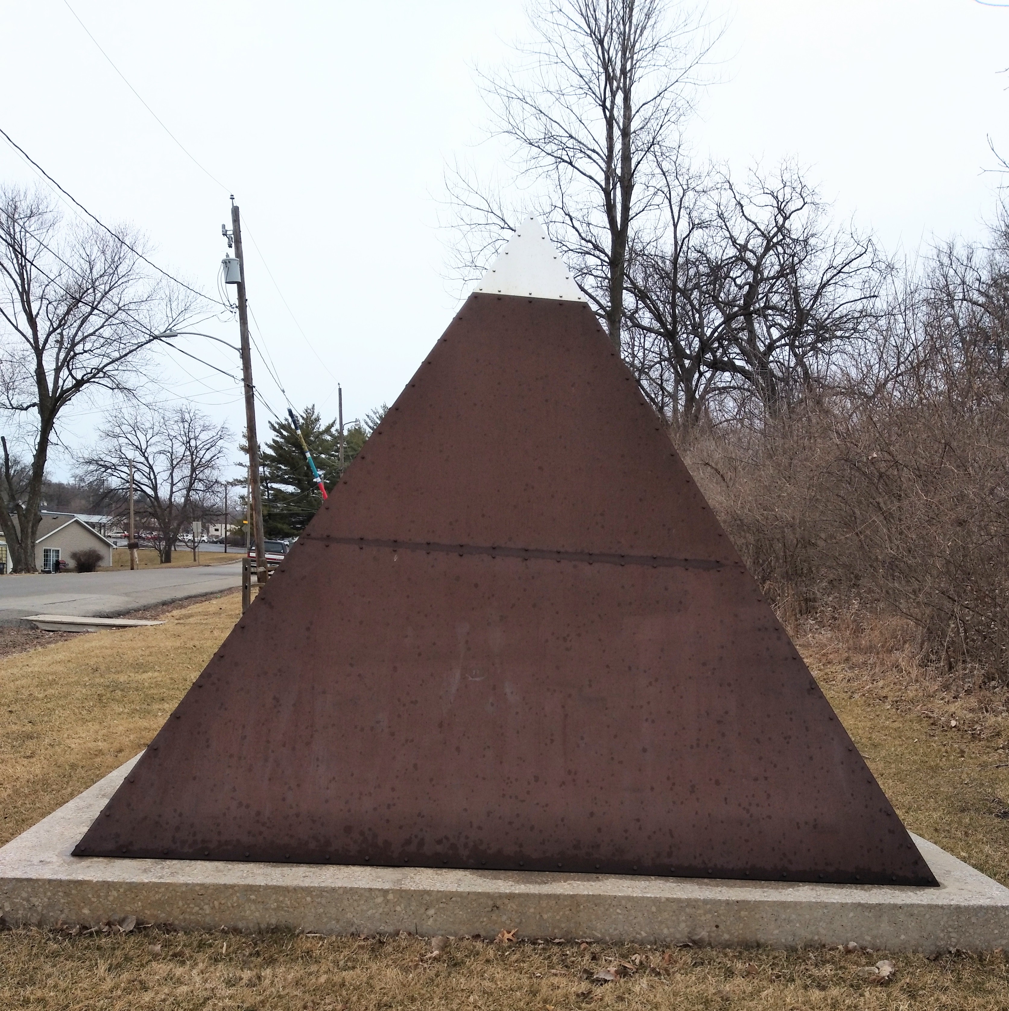
We are a half mile from the park.  The road is narrow and traffic has increased somewhat.  The shoulder is a rocky mess with cars parked close to the street.  The sidewalk on the northside is narrow and does not look smooth or safe.  Now we cross SW 9th and the sculpture park is on the right behind the bar.  The park is on a narrow stretch of land in a hilly residential area.  None of the works have titles or credits to the artists on them.  A rudimentary internet search resulted in a few Trip Advisor reviews and a Facebook page.  Here are the photos I took of all the "open" exhibits.  A few are covered and were not photographed.


UNI colors!


My favorite.  I should have walked around to the other side to avoid the house.

THE RIDE HOME

We took the same way back.  I climbed McKinley without getting my right shoe clicked in.  Annoying but I needed speed since there was traffic.  Cars gave us room.  Instead of going immediately home we diverted to a cinnamon roll café in the East Village.  Mary ordered a raspberry Danish and a hot chocolate and I an "old school" cinnamon roll and a coffee.  Unfortunately, the cashier did not hear me or understand me and I received coffee only.  A glance at the receipt showed that only 3 items were ordered.  I tried to go back and order, but new customers were walking in every time.  Oh well, I just saved 2000 calories.  I was not happy.

Then we stopped at the store for oatmilk.  Recent calcium scoring suggests that I give up half and half for my daily coffee (like a cinnamon roll is any better).  Two potential bridge beers were also purchased since I need a photo.  But when we got back to our bikes, the rain had intensified then stopped.  Looking at the clocks on the bikes it was noon, the time the internet said the rain would begin.  Just go home.  Fortunately, the rain was over but the streets were wet and we were cold.  No bridge beers.  A few hours later the sun came out.  Should have waited...


Friday, February 17, 2023

Snow Day and First Bridge Beer of 2023


The confluence of the Des Moines and Raccoon Rivers.

The forecast called for any amount from 3 to 7" of snow.  We got 5.7" in my fair city while I was at work today.  The snow was supposed to start at 3 am and every time one of woke up we'd look out the window and see nothing.  I think the snow started around 445 am in my neighborhood. Maybe a quarter inch was on the ground when I left for my place of employment at 530 am.  15 mph headwind was present to keep me awake.  People thought I was crazy for riding my bicycle to work.  But as I tell them "I just look stupid riding my bike for 2 miles each way.  In a car, bad things could happen."  And bad things happened.  Reports of cars sliding through intersections and my middle son totaled his Jeep on ice today.  My Honda and Pontiac, very snug at home.  Studded tires, lights and dress for the weather.  It was fun!  I drove, 7°F did not seem appealing, the next day and followed a Ford that did not have its headlights on.  Despite flashing her several times she just drove on without lights.  "If everyone has lights on why should I have mine on?  They can see me.  You saw me.  I saw them."

Nothing to note about the ride to work.  Not much snow and the streets were wet to clear.  The snow off to the side had round dark marks where salt landed and burnt a hole in the fresh snow.  I should have put my contact lenses in so I could wear my ski goggles but that would have taken thought and effort.  As it was the snow had an icy bite on the exposed skin of my face and my huge nose.  Crossing the pedestrian bridge to the service road for Principal Park (minor league baseball field) was the same.  I spotted some virgin snow next to the eastern curb, so I headed over there and rode on it until I heard the surface crunch as I was now on a thin layer of ice covering the puddle next to the curb.  Best return to the middle of the road.  I was successful here although there was one quick spin of the rear wheel indicating that it had lost traction.  Then battle the wind as I rode to the sheltered bike rack.  Rode on the wrong lane on Watson Powell Jr Way because the service that removes the snow on the parking Lot #34 along Weitz Construction Company merely piles it up near the sidewalk and as the snow melts it creates ice and black ice on the street.  Safety hazard.  I was the first one there!  I was the only one that used that rack.  No one else rode. 

This photo was taken to show my butcher that my winter specific tires collect snow.  The last few times I have visited him he had been lamenting that his 29" MBT tires have been packing up with snow.  I probably lower my PSI.

All day I watched the snow and the wind.  7th Street never looked plowed.  When it was time to leave, I would have a tailwind.  I took the short route home.  Streets were not the best.  Smashed snow that the rear wheel likes to drop through a layer randomly and jerk the bike from the loss of momentum.  Soon Buick Park Avenue spun its way through a turn.  Crap tires that won't be replaced until cords start showing when the tread disappears.  Looking for the cleanest line was the game.  Even Court Ave was crap.  I elected to ride on the sidewalks careful to avoid the visiting families here to enjoy the State Wrestling Tournament.  My mission at that store was to purchase bootlaces for Mary and myself since she said hers were on the last string.  No laces at 420 Court Ave Hy Vee so I bought a beer.  Why not?  I'd be crossing a bridge soon.

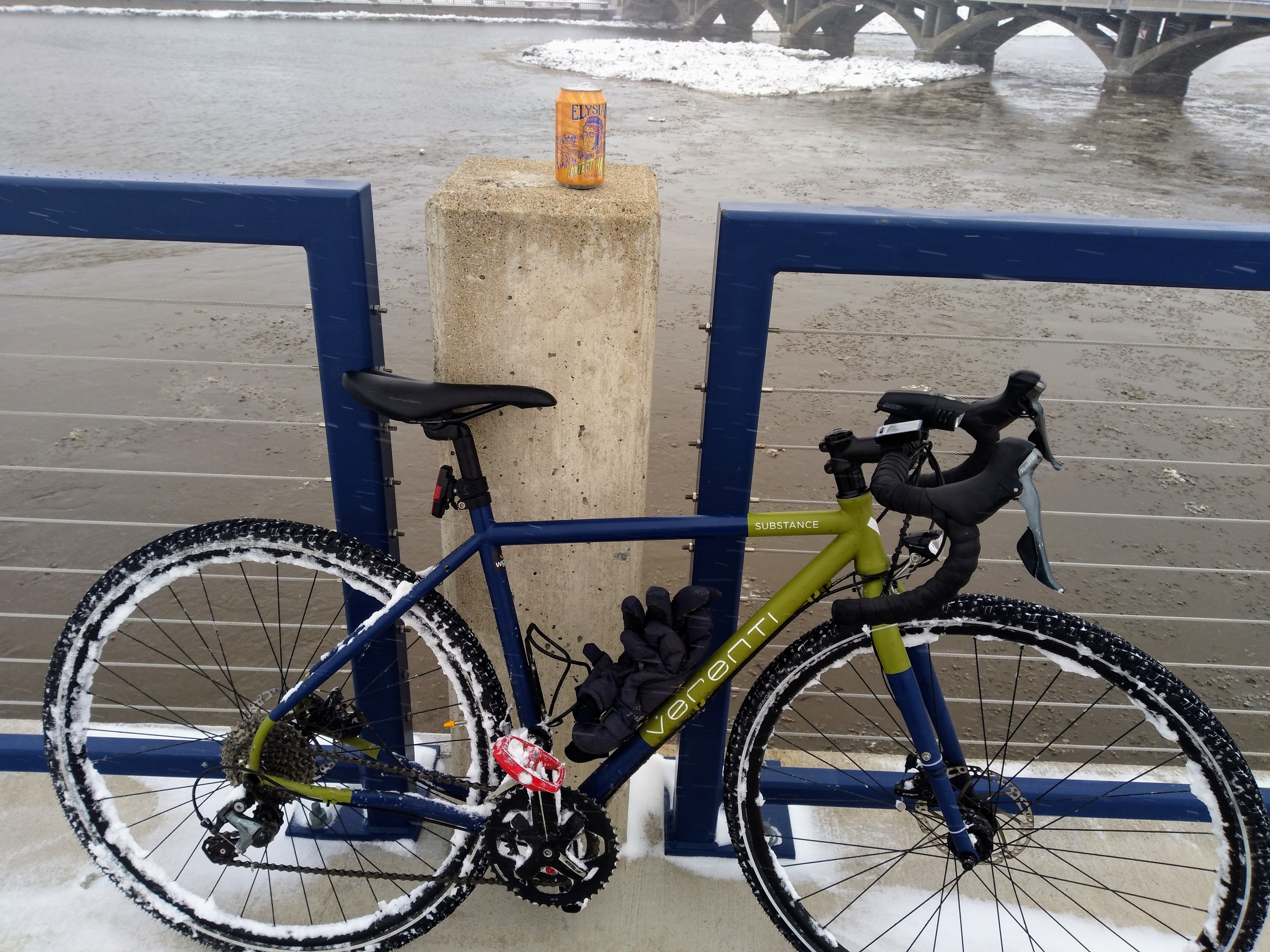
My first Bridge Beer of 2023.  I have significantly reduced my consumption.  I have beer in the refrigerator that I purchased for Thanksgiving.  It will be Presidents Day next week!

That bright thing in the sky is not a Chinese spy balloon, rather, it is the sun.

The pedestrian bridge between the ballpark and Mullets had been cleared but additional snow and blowing snow created snow piles over two feet deep.  But that did not stop me from enjoying a beer.  I turned my back to the wind and drank its hoppy goodness.  The outside temperature was a balmy 23°F.  Wind was a calm 15 to 25 mph.  Wind chill readings are for the weak.


Peace out!!

Friday, January 20, 2023

So it Snowed


Pulled off the Principal River Walk for this photo op.  Had I waited one minute, Mary's bike would have been visible, her NiteRider with new batteries anyway, where those street lights are.  Of note, when the city clears the snow from this trail, they also clear off the goose poop.  We have a problem with these dirty birds.

Not much goes on in the great state of Iowa during the winter.  But if a weather event is coming, the Weather People drink jars of coffee and take some of these and get totally wired.  Iowans get near hurricane level of warning of a potential snowflake falling on the land between two rivers.  And so it was for the week of January 15-20, 2023.

Wednesday, January was D-Day err S-Day.  For Capital City, Des Moines, on the edge of the Warning/Watch/Ground Zero calls for upwards to 7" were made.  As S-Day and 0-Hour approach, 3-5" were the final guess.  The "official" total at the airport was 4.8" but I think my neighborhood to downtown received 3".  But it was a wet and heavy snow.

I had to be at work by 6 am Thursday.  I was prepared.  The Verenti Substance, my gravel/adventure/zerstörer/heavy road bike was ready.  Sitting uselessly in my kitchen with its 45North studded tires and gen hub light, it was time to put it to work.  Lace on some boots, dress for a wet 31°F and head north.  At the last possible moment, Mary said her light had dead batteries and I almost pulled the AA NiteRider off the Verenti (I kept the mount on and placed a light on it for comparison purposes since the Busch-Mueller is new to me) but decided to stop what I was doing and find her a fresh pair of AA batteries.

Off I go into the silent white death.  Of course, since the snow began in earnest at 7 pm the night before and just ended as I was prepping to leave, and enough cars had driven on the street to destroy all traces of virgin snow making riding anything other than a fatbike with 7 psi in its tires a pain I elected to take the sidewalk for the 3 blocks necessary to reach the plowed road.  It was a good thing that I kept the NiteRider as I could keep the front wheel spinning fast enough to provide solid light.  Weird.  But when I reached 1st Street I adequate speed for have light.

The pedestrian bridge and trail to Gray's Lake was cleared.  Well, half the bridge was done.  The concrete blocks that prevent people from driving their fishing trucks/cars on the bridge also prevent city snowplow trucks from accessing it.  So UTVs have to clear the snow on that bridge.  The rest of the journey to work was fine.  I saw one set of bicycle tracks.  I also padded my miles by biking a longer route.  Traffic consisted mostly of any vehicle that could carry a blade to push snow.

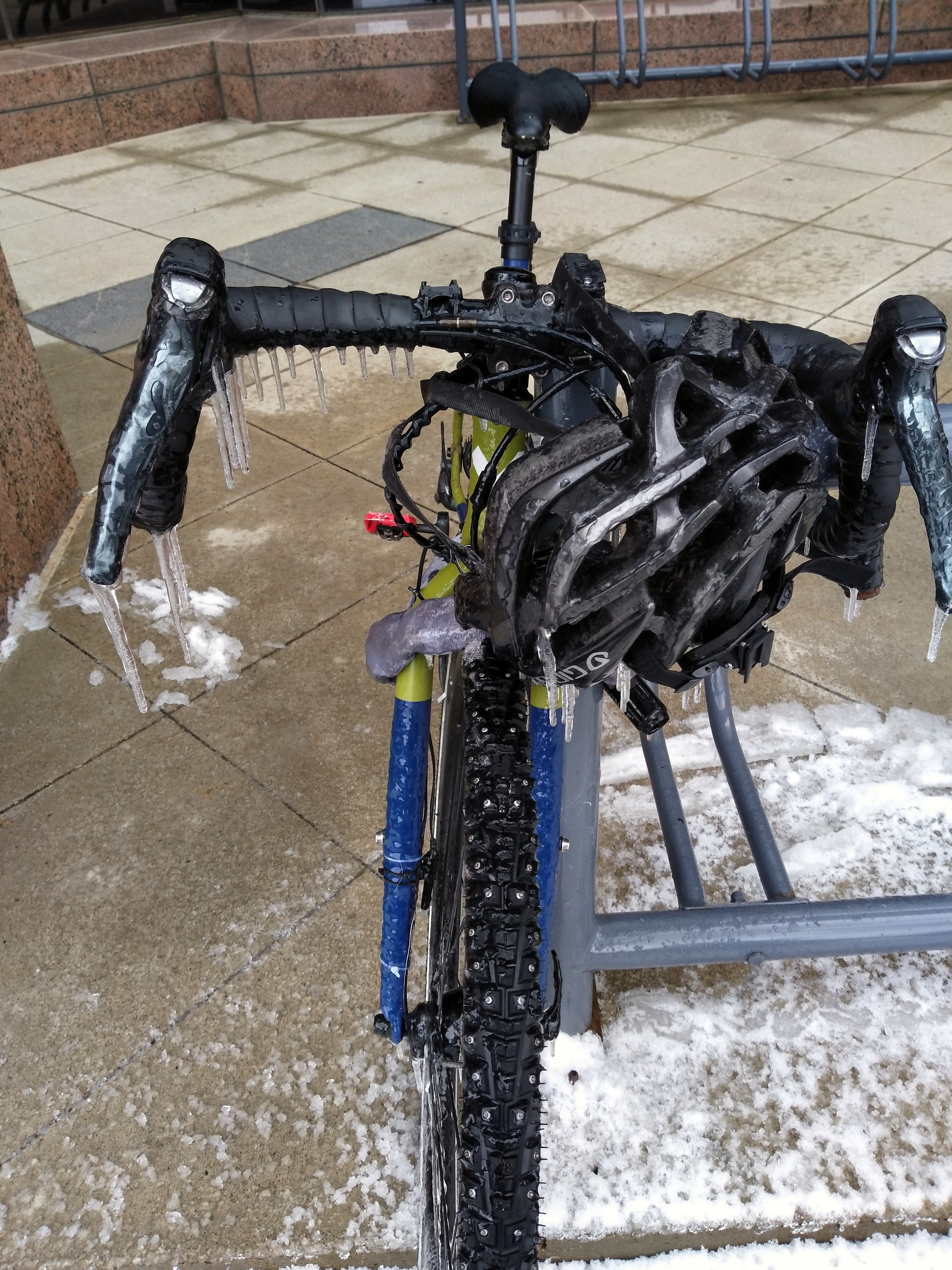
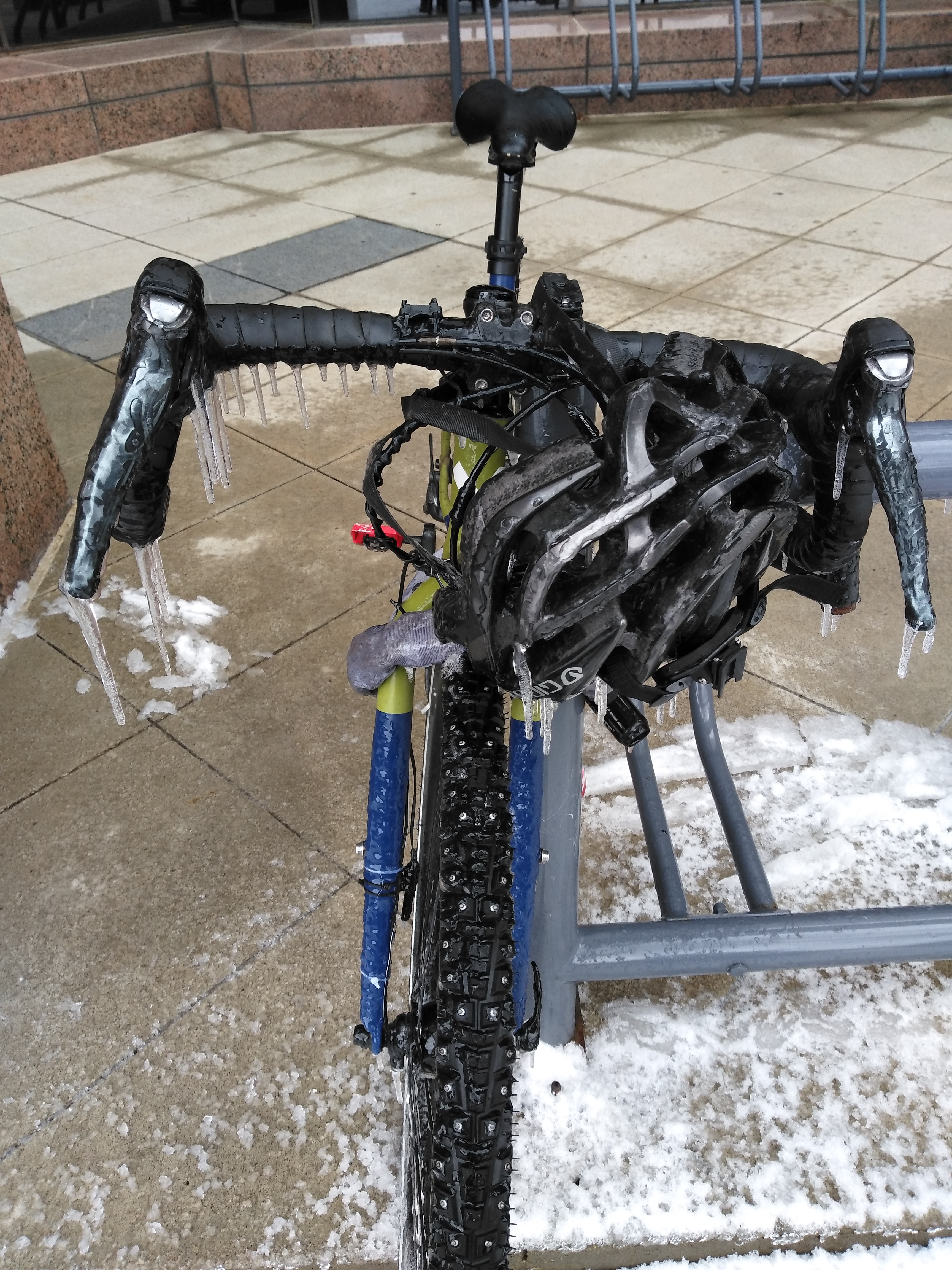
Soon the decision of where to park had to be made.  My usual spot is next to the building that I work in.  There is a modicum of protection from rain and snow as long as it is a light rain or snow.  But if the precipitation looks bad, I park across the street in a well-protected area.  I chose the former.  When I parked at the rack, I noticed that the batteries in my NiteRider were dead.  Glad I did not give that light to Mary!  We were to receive on a light amount of snow when the counterclockwise rotation blows in the left-over arm of the system.  It did snow for a bit.  However, I did not count of melting snow being blown on to the bicycle.  The "cockpit" of the bike was more than glazed with ice.  My helmet had spikes!  Would my head get wet as the ice melted from the escaping heat of my noggin?  I was not sure if the brakes would work.  No scraper so I dropped the helmet in an attempt to remove ice.  A few karate chops on the brake levers to get them to move.  Used my keys to chip ice from the computer mount.  Unfortunately, one must remove lights, flashers and computers from bikes lest they be stolen.

I place my helmet out front to hide the gen hub light.  My faith in humanity is so low that I think someone may contemplate pulling it off.

These bicycle racks suck.  Difficult to park bikes with disc brakes in them.  I like to use the side of the rack.  Perhaps I should use the rack against the building.  I have yet to see a bike parked at that one.


The bike functioned adequately, and I got home safely.  I even stopped at the store on the way home. Back inside the house to thaw out.  I placed the helmet on the sink to melt!  Lesson learned: on days like this, park across the street.  BTW I did see a heavy roadie parked at the protected racks.  Smart person!


Sunday, January 1, 2023

2022 In Review


The Myth of Chevian Bicycling!  January 1, 2023.  Second night in a new bed and new bedroom thus a restless night's sleep.  The need for coffee finally overwhelms me and I arise at 6 am.  After taking care of the livestock, dog and cat, and brewing that precious coffee I go to my computer and make the final entry for 2022.  I'm lo-tech.  I use wired Cateye computers and enter the readings manually onto an Excel spreadsheet.  Then I send the documents to the Mothership somewhere in Cyberland.  Back in the early 1990s this was done on pen and paper.  My Excel Bike Log goes back to 1994.

A new year and a new task.  Record all the odometer readings for every bike ridden the previous year.  Start with December's entries and go through 2022 backwards.  This is the easiest way to get the final reading for each bike.  At least one bike had a computer stolen or broken and thus did not record every mile.  Interesting as going backwards through time reveals when the last ride for each bike was.

Of note:

Trek 520--552 miles last ridden on July 27th when we completed our ride across Minnesota.  I like to use this bicycle for its intended purpose, touring, not hauling beer for a 15 mile ride.

Tandems--we have two, one for touring and one fast one.  At time of purchase our most expensive bicycles.  Despite lots of miles in 2020 exploring empty trails during rides of "isolation" the Fisher Gemini did not roll once in 2022.  Our Cannondale RT3000 was ridden once for 39 miles in 2022.

Gravity Vanquish--single speed commuter accumulated 615 miles mostly on the daily 4 mile round trip to work and back.  It would have gathered more miles but it needs brake pads that for some reason I have not been arsed to order yet.

Verenti Substance--imported gravel/adventure bicycle that really has not seen gravel but makes a great all around bike from loaded touring with front and rear panniers to now fitted with studded tires for 3 months of dangerous conditions.  This bike took over commuting duty.  I added a gen hub lighting system thanks to Chris Cornelius selling me a set of wheels with the required hub.  It was the only bicycle I rode in November.  With the exception of another bike, the Verenti was the only bicycle I rode in December.

Trek FX 7.5-- 15 winters of commuter service.  167 miles.  I retired this bike last week.  Too much work ($) needs to go into it.  Frame looks damaged as well.  Removed its 45 studded tires.  I will purchase a disc braked hybrid sometime this year to replace it.

Highlights of riding this year:

RASDak--Ride Across South Dakota.  Takes 7 days.  Took my Domane and discovered that dual Iso Speed shock systems makes a flexy bike hat 39 mph when trying to get that 40+ mph.  When organized ride.  Place to stay every night and showers every day.  Imagine a well-organized Ragbrai with only 200 riders?  Paradise!

St Cloud, MN to Fargo, SD and back.  Two seamlessly interconnected paved trails for 140 miles with towns every 5 or 6 miles!  Flat, beautiful, peaceful.  Fergus Falls to Fargo and back, one day each way, on smooth empty county highways.  We did this instead of Ragbrai.  Need to do this again with friends.  "If you could just see the beauty, these things I can never describe."

My riding really died out toward the end of the year.  Seemed to rain every weekend.  I got salmonella during thanksgiving break.  Then it got cold.  Then the Arctic Blast dropped temperatures to -10°F.  Motivation?  There was none.  Knowing that the FX was dead and trying to determine which bike should get the studded tires also held me back.  Which bicycle to sacrifice?  A few months won't hurt, will it with all the salt and sand and dirty snow and freeze/thaw cycles...  2022 was my lowest mileage years since 2009.

So I plan to smoke some Hopium and ride more in 2023.  Take a chance and say I tried.


Saturday, September 3, 2022

Red Rock Prairie Trail: New Trail New Tires


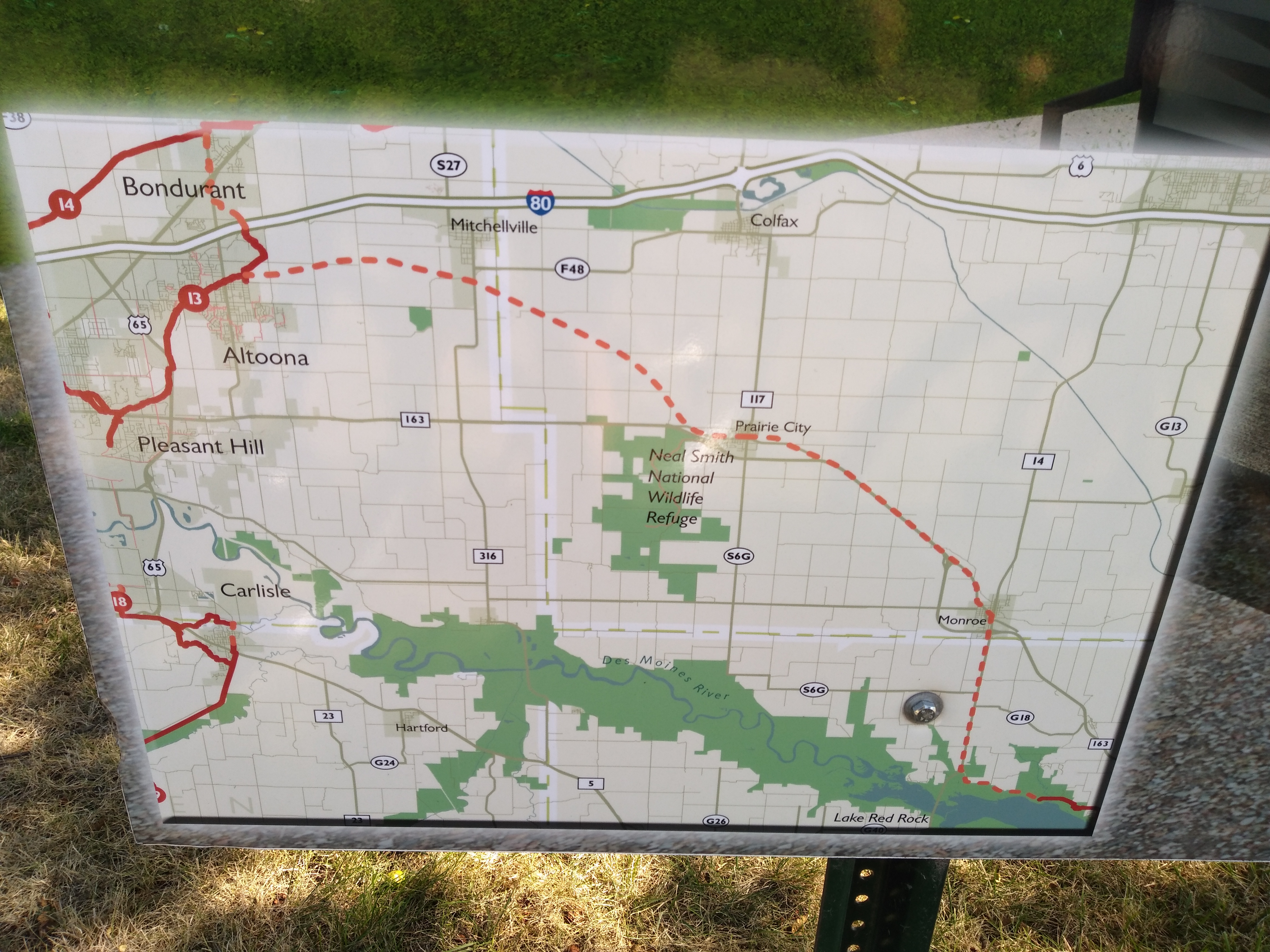
The latest part of the Central Iowa Trail system opened this week.  The Red Rock Prairie Trail.  When completed the trail will originate in Bondurant, Iowa, and end up Cordova Park at Lake Red Rock and link up with the Volksweg Trail that visits the lake and goes into Pella, Iowa.  For now, the completed section is open from Prairie City to Monroe, Iowa.  Nearly 10 miles in length as is.  Mary and took the opportunity to ride it today.

In the future, the trail will begin in Bondurant on the Chichaqua Trail and connect to the Gay Lea Wilson Trail in Altoona.  From Monroe it looks like a parallel trail/sidepath along highway 14 to Cordova Park where it will connect with the Volksweg Trail.  For the adventurous, take SE Vandalia Rd out of Des Moines to Runnels and then F70 to Monroe.  Mary and I saw the Dream Team take this route a few summers ago.


File photo from our 2020 exploration of Prairie City and the Neal Smith National Wildlife Refuge across the highway.

Another file photo from the previous ride.  I failed to take a photo of the bison this time.

We left our vehicle at Entryway Park, the place with the bison statue, next to the Casey's off of Highway 163 in Prairie City.  After driving through town, we determined that this was the trailhead.  No signage.  The trail crosses the road/highway exit instead taking the existing Prairie City Recreational Complex trail system.   Be aware that there are sandy spots here and I had to stop and wipe off my new tires as the sand and crap stuck to the new rubber.  Literally, I installed them prior to leaving and the only distance they rolled was from my living room to my car.  Once across the highway the trail curves about a bit to take one through downtown square area and finally to the open countryside.

Mural in Prairie City.  We took fast bikes since this was a mere recce ride.

The surface of this trail is concrete.  So new that black Bobcat tire marks are still visible showing off the endless circles they made during construction.  Flat rail grade.  Very few trees except near Monroe.  No benches yet.  There are a few bump outs of concrete that allow for access to the farm fields.  I doubt benches will be placed on theses.  No signage.  A few mile markers are near Monroe.  In fact, the markers begin a mile outside Monroe.  The last one we saw was "5".  Seemed odd to have mile markers on an incomplete trail because there will be a section north of Prairie City and another south of Monroe.  At the minimum, the numbers will be replaced.  Most likely, the posts will also need to be relocated to show true distance.  Without fanfare or notice, the trail terminates in Monroe just south of the square.  

The trail is built on a former rail line that follows highway 163 and old highway 163.  Since Mary and I are from southeast Iowa we spent a lot of time looking out of car windows as our families traveled to Des Moines from Ottumwa along 163.  We watched the conversion of the two lane 163 into a four lane highway.  The towns along the way were bypassed so people could drive their vehicles faster without stopping.  My father once said that the four lane would not be completed in his lifetime.  He was almost right.  Once my addiction to bicycling sunk its claws into me I'd stare at those railroad tracks and think that it would make a nice trail.  And it is although it could use trees to block the wind, sun and view of highway 163.  Perhaps in my lifetime.  It is after all, a new trail.

Rolling out of Prairie City we encountered a family on bicycles and people walking.  It lightened my heart to see locals taking advantage of a beautiful and enjoy their newest community asset.  On the way back we saw a woman on a trike recumbent and her son on his own bike.  Glasses, freckles, Bass Pro cap and an ear-to-ear grin on his face, "the bugs are insane!" he shouted as we passed.  I didn't want to correct him by informing him that grasshoppers lack enough brains to develop an antiquated medical condition.  Yes, there were plenty of grasshoppers sunning themselves on the hot concrete, but it is late summer and that is what they do.  "Try to run them over," I replied.  Bad humor.  I was more concerned about the ragweed and the fact that our tires were turning green from that.  But yes, are spokes have a lot of grasshopper guts on them now!

Mary told me that I have too many bikes for our house.  If we lived here, then yes.

Somewhere on G40 between Pleasantville and highway 14 is a sign for Red Rock.

"Clark, the shittar is small!"

We rode around the square in Monroe.  Spotted a Mexican restaurant that would make a nice destination ride some evening.  Around the corner was another eatery.  The bar, Mike's Lounge, on the other side of the square also sells tacos and pizza.  But the main attraction was the Replica House.  A model of a stone house built in Red Rock, Iowa, once an attraction just off of 163 but the bypass of the new highway hid this little gem.

Prairie City itself has some nice features.  Coffee shops, restaurants and pubs.  We noted these when we first drove into town looking for the trailhead.

This is a nice addition to our trail system.  I hope the other sections are completed soon.  We are already looking for routes to this trail from Des Moines for a longer ride.  Do yourself a favor and visit the Red Rock Prairie Trail.